 Old Cumbria Gazetteer
 |
 |
|
| South End Farm, Walney Island | ||
| South End Farm | ||
| Street:- | Hare Lane | |
| locality:- | South End | |
| locality:- | Walney Island | |
| civil parish:- | Barrow-in-Furness (formerly Lancashire) | |
| county:- | Cumbria | |
| locality type:- | buildings | |
| coordinates:- | SD20416327 | |
| 1Km square:- | SD2063 | |
| 10Km square:- | SD26 | |
| references:- | Listed Buildings 2010 |
|
|
|
||
| evidence:- | old map:- West 1784 map placename:- South End |
|
| source data:- | Map, hand coloured engraving, A Map of the Lakes in Cumberland,
Westmorland and Lancashire, scale about 3.5 miles to 1 inch,
engraved by Paas, 53 Holborn, London, about 1784.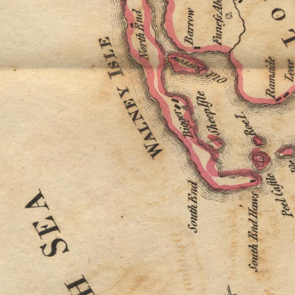 Ws02SD16.jpg item:- Armitt Library : A1221.1 Image © see bottom of page |
|
|
|
||
| evidence:- | old map:- Hydrographic Office 1850s onwards placename:- South End Farm |
|
| source data:- | Chart, uncoloured engraving, England West Coast sheet XI,
Fleetwood to the Firth of Solway, scale about 2.5 miles to 1
inch, by H Denham and G Williams, 1846, engraved by J and C
Walker, published by the Hydrographic Office, 1850 corrected to
1863 coast views on Admiralty chart 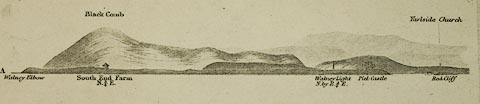 click to enlarge click to enlargeHY01P2.jpg "South End Farm" 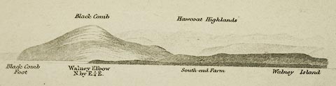 click to enlarge click to enlargeHY01P4.jpg "South-end Farm" item:- Carlisle Library : Map 93 Images © Carlisle Library |
|
|
|
||
| evidence:- | database:- Listed Buildings 2010 placename:- South End Farm item:- date stone (1764) |
|
| source data:- | courtesy of English Heritage "SOUTH END FARMHOUSE AND ATTACHED FARM BUILDINGS / / HARE LANE / BARROW IN FURNESS / BARROW IN FURNESS / CUMBRIA / II / 388473 / SD2041563270" |
|
|
|
||
 Lakes Guides menu.