 Old Cumbria Gazetteer
 |
 |
|
| Old Vicarage, Skirwith | ||
| Old Vicarage | ||
| Skirwith Vicarage | ||
| locality:- | Skirwith | |
| civil parish:- | Culgaith (formerly Cumberland) | |
| county:- | Cumbria | |
| locality type:- | buildings | |
| coordinates:- | NY61733246 | |
| 1Km square:- | NY6132 | |
| 10Km square:- | NY63 | |
| references:- | Listed Buildings 2010 |
|
|
|
||
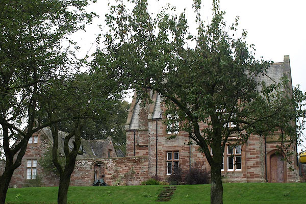 BVN28.jpg (taken 14.10.2011) 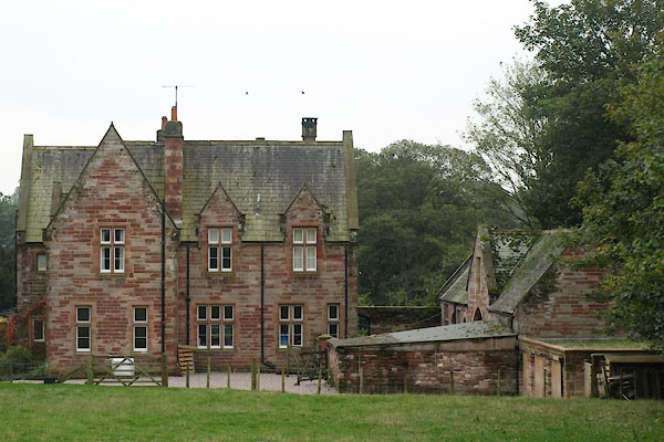 BVN27.jpg From the churchyard. (taken 14.10.2011) |
||
|
|
||
| evidence:- | old map:- OS County Series (Cmd 51 13) placename:- Parsonage, The |
|
| source data:- | Maps, County Series maps of Great Britain, scales 6 and 25
inches to 1 mile, published by the Ordnance Survey, Southampton,
Hampshire, from about 1863 to 1948. |
|
|
|
||
| evidence:- | database:- Listed Buildings 2010 placename:- Skirwith Vicarage |
|
| source data:- | courtesy of English Heritage "SKIRWITH VICARAGE AND ATTACHED COACH HOUSE AND STABLES / / / CULGAITH / EDEN / CUMBRIA / II[star] / 351324 / NY6173432456" |
|
|
|
||
 Lakes Guides menu.