 Old Cumbria Gazetteer
 |
 |
|
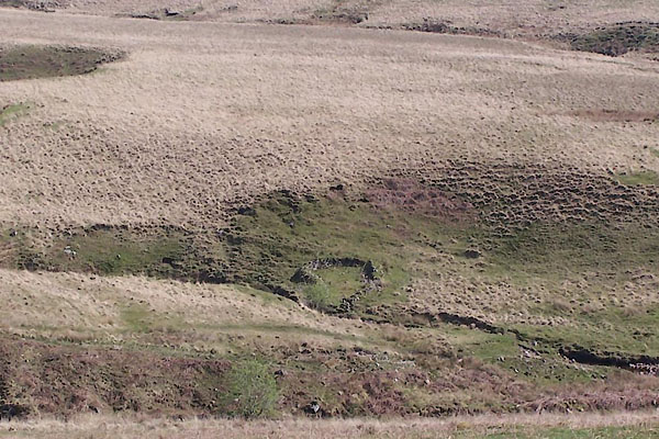
| sheepfold, Ennerdale and Kinniside (2) | ||
| civil parish:- | Ennerdale and Kinniside (formerly Cumberland) | |
| county:- | Cumbria | |
| locality type:- | sheepfold | |
| locality type:- | wash fold | |
| coordinates:- | NY09350939 | |
| 1Km square:- | NY0909 | |
| 10Km square:- | NY00 | |
|
|
||
 BUL92.jpg (taken 27.4.2011) |
||
|
|
||
| evidence:- | old map:- OS County Series (Cmd 73) |
|
| source data:- | Maps, County Series maps of Great Britain, scales 6 and 25
inches to 1 mile, published by the Ordnance Survey, Southampton,
Hampshire, from about 1863 to 1948. "Washfold" |
|
|
|
||
 Lakes Guides menu.