 Old Cumbria Gazetteer
 |
 |
|
| roman fort, Eden Mouth | ||
| Tunnocellum | ||
| locality:- | Eden, River | |
| civil parish:- | ||
| county:- | Cumbria | |
| locality type:- | roman fort | |
| 10Km square:- | NY36 | |
| 1Km square:- | NY3060 | |
| 10Km square:- | NY36 | |
| SummaryText:- | Unlocated roman fort | |
|
|
||
| evidence:- | possibly old map:- Pennant 1777 placename:- Tunnocelum |
|
| source data:- | Map, hand coloured engraving, A Map of Scotland, Hebrides and
Part of England, drawn for Thomas Pennant, engraved by J Bayly,
published by Benjamin White, London, 1777.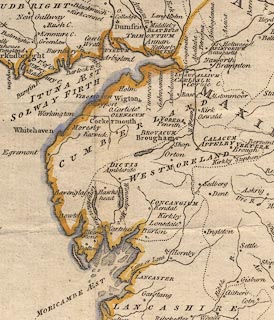 click to enlarge click to enlargePEN1Cm.jpg "Tunnocelum" square; roman camp on Hadrian's Wall item:- private collection : 66 Image © see bottom of page |
|
|
|
||
 Lakes Guides menu.