 Old Cumbria Gazetteer
 |
 |
|
|
| road, through St Bees | |||
| St Bees road | |||
| civil parish:- | St John Beckermet (formerly Cumberland) | ||
| civil parish:- | Lowside Quarter (formerly Cumberland) | ||
| civil parish:- | Egremont (formerly Cumberland) | ||
| civil parish:- | St Bees (formerly Cumberland) | ||
| civil parish:- | Whitehaven (formerly Cumberland) | ||
| county:- | Cumbria | ||
| locality type:- | road route | ||
| 10Km square:- | NY00 | ||
| 10Km square:- | NX90 | ||
| 10Km square:- | NX91 | ||
|
|
|||
| evidence:- | old map:- Donald 1774 (Cmd) |
||
| source data:- | Map, hand coloured engraving, 3x2 sheets, The County of Cumberland, scale about 1
inch to 1 mile, by Thomas Donald, engraved and published by Joseph Hodskinson, 29
Arundel Street, Strand, London, 1774. double line, solid or dotted, tinted red; turnpike road 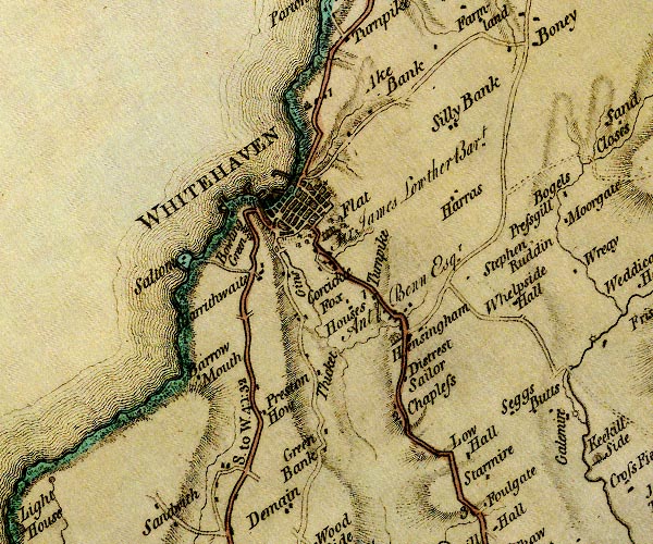 D4NX91NE.jpg "S. to W. 4:1:32" miles.furlongs.poles; St Bees to Whitehaven 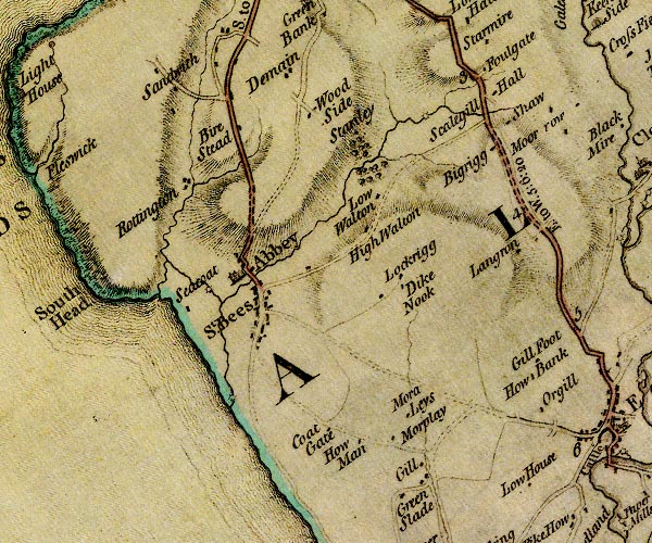 D4NX91SE.jpg item:- Carlisle Library : Map 2 Images © Carlisle Library |
||
|
|
|||
| evidence:- | old map:- Donald 1774 (Cmd) |
||
| source data:- | Map, hand coloured engraving, 3x2 sheets, The County of Cumberland, scale about 1
inch to 1 mile, by Thomas Donald, engraved and published by Joseph Hodskinson, 29
Arundel Street, Strand, London, 1774.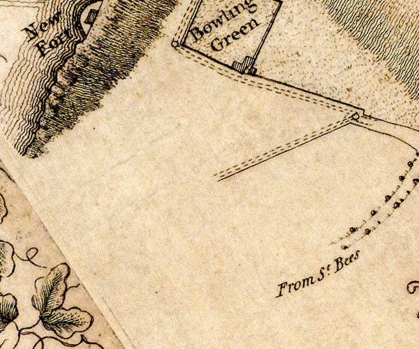 D49618Q.jpg "From St. Bees" road out of town item:- Carlisle Library : Map 2 Image © Carlisle Library |
||
|
|
|||
| evidence:- | old map:- Hall 1820 (Cmd) |
||
| source data:- | Map, hand coloured engraving, Cumberland, scale about 21 miles
to 1 inch, engraved by Sidney Hall, published by S Leigh, 18
Strand, London, 1820-31. click to enlarge click to enlargeHA14.jpg single line, solid; minor road; ... St Bees ... item:- JandMN : 91 Image © see bottom of page |
||
|
|
|||
| places:- |  St Bees Whitehaven St Bees Whitehaven |
||
|
|
|||
Lakes Guides menu.