 Old Cumbria Gazetteer
 |
 |
|
| Preston Patrick | ||
| civil parish:- | Preston Patrick (formerly Westmorland) | |
| county:- | Cumbria | |
| locality type:- | locality | |
| coordinates:- | SD55418402 (etc) | |
| 1Km square:- | SD5584 | |
| 10Km square:- | SD58 | |
|
|
||
| evidence:- | old map:- Mercator 1595 (edn?) placename:- Preston |
|
| source data:- | Map, hand coloured engraving, Westmorlandia, Lancastria, Cestria
etc, ie Westmorland, Lancashire, Cheshire etc, scale about 10.5
miles to 1 inch, by Gerard Mercator, Duisberg, Germany, 1595,
edition 1613-16. MER5WmdA.jpg "Preston" circle item:- Armitt Library : 2008.14.3 Image © see bottom of page |
|
|
|
||
| evidence:- | old map:- Bowen and Kitchin 1760 placename:- Preston Patrick |
|
| source data:- | Map, hand coloured engraving, A New Map of the Counties of
Cumberland and Westmoreland Divided into their Respective Wards,
scale about 4 miles to 1 inch, by Emanuel Bowen and Thomas
Kitchin et al, published by T Bowles, Robert Sayer, and John
Bowles, London, 1760.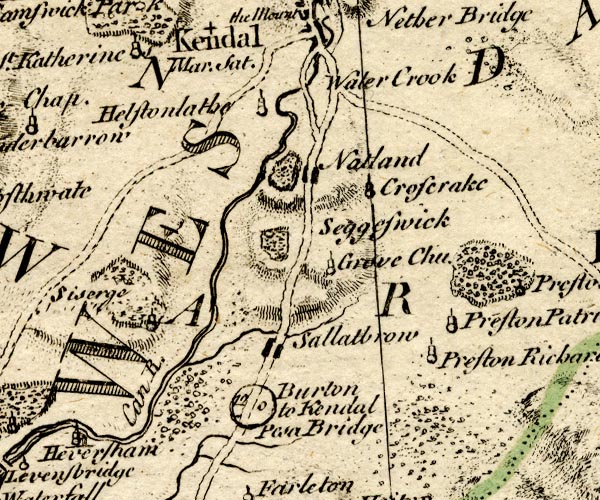 BO18SD48.jpg "Preston Patrick" circle, tower item:- Armitt Library : 2008.14.10 Image © see bottom of page |
|
|
|
||
| evidence:- | old map:- Jefferys 1770 (Wmd) placename:- Preston Patrick |
|
| source data:- | Map, 4 sheets, The County of Westmoreland, scale 1 inch to 1
mile, surveyed 1768, and engraved and published by Thomas
Jefferys, London, 1770.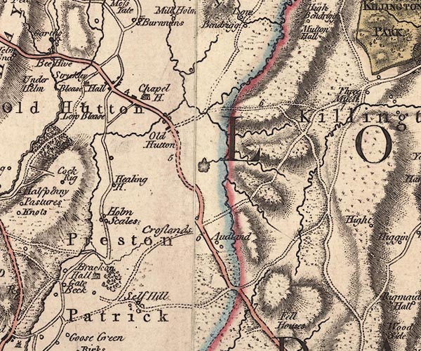 J5SD58NE.jpg "Preston Patrick" area item:- National Library of Scotland : EME.s.47 Image © National Library of Scotland |
|
|
|
||
| evidence:- | old map:- Cary 1789 (edn 1805) placename:- Preston Patrick |
|
| source data:- | Map, uncoloured engraving, Westmoreland, scale about 2.5 miles
to 1 inch, by John Cary, London, 1789; edition 1805.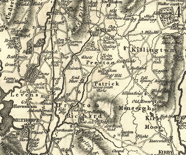 CY24SD58.jpg "Preston Patrick" area item:- JandMN : 129 Image © see bottom of page |
|
|
|
||
| evidence:- | old map:- Cooper 1808 placename:- Preston Patrick |
|
| source data:- | Map, hand coloured engraving, Westmoreland ie Westmorland, scale
about 9 miles to 1 inch, by H Cooper, 1808, published by R
Phillips, Bridge Street, Blackfriars, London, 1808. click to enlarge click to enlargeCOP4.jpg "Preston Patrick" circle; village or hamlet item:- Dove Cottage : 2007.38.53 Image © see bottom of page |
|
|
|
||
 Lakes Guides menu.