 Old Cumbria Gazetteer
 |
 |
|
| Pool House, Grayrigg | ||
| Pool House | ||
| civil parish:- | Grayrigg (formerly Westmorland) | |
| county:- | Cumbria | |
| locality type:- | buildings | |
| coordinates:- | SD61949636 | |
| 1Km square:- | SD6196 | |
| 10Km square:- | SD69 | |
| references:- | Listed Buildings 2010 |
|
|
|
||
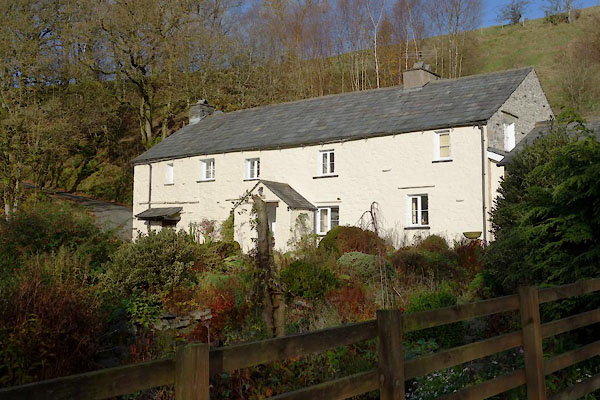 CCA49.jpg (taken 5.11.2014) |
||
|
|
||
| evidence:- | old map:- OS County Series (Wmd 34 12) placename:- Pool House |
|
| source data:- | Maps, County Series maps of Great Britain, scales 6 and 25
inches to 1 mile, published by the Ordnance Survey, Southampton,
Hampshire, from about 1863 to 1948. |
|
|
|
||
| evidence:- | database:- Listed Buildings 2010 placename:- Pool House |
|
| source data:- | courtesy of English Heritage "POOL HOUSE AND ATTACHED OUTBUILDING / / / GRAYRIGG / SOUTH LAKELAND / CUMBRIA / II / 75654 / SD6192996359" |
|
|
|
||
 Lakes Guides menu.