 Old Cumbria Gazetteer
 |
 |
|
| Oldbridge, Broughton | ||
| Oldbridge | ||
| Pennybridge | ||
| civil parish:- | Broughton (formerly Cumberland) | |
| county:- | Cumbria | |
| locality type:- | buildings | |
| coordinates:- | NY07503079 | |
| 1Km square:- | NY0730 | |
| 10Km square:- | NY03 | |
| references:- | Listed Buildings 2010 |
|
|
|
||
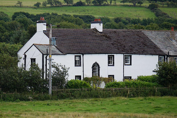 CDV43.jpg (taken 4.9.2015) |
||
|
|
||
| evidence:- | old map:- OS County Series (Cmd 54 2) placename:- Oldbridge |
|
| source data:- | Maps, County Series maps of Great Britain, scales 6 and 25
inches to 1 mile, published by the Ordnance Survey, Southampton,
Hampshire, from about 1863 to 1948. |
|
|
|
||
| evidence:- | database:- Listed Buildings 2010 placename:- Pennybridge |
|
| source data:- | courtesy of English Heritage "PENNYBRIDGE AND ADJOINING BARN / / / BROUGHTON / ALLERDALE / CUMBRIA / II / 72221 / NY0750430791" |
|
|
|
||
 Lakes Guides menu.