 Old Cumbria Gazetteer
 |
 |
|
| Old Vicarage, Thursby | ||
| Old Vicarage | ||
| Street:- | Church Lane | |
| locality:- | Thursby | |
| civil parish:- | Thursby (formerly Cumberland) | |
| county:- | Cumbria | |
| locality type:- | buildings | |
| coordinates:- | NY32445030 | |
| 1Km square:- | NY3250 | |
| 10Km square:- | NY35 | |
| references:- | Listed Buildings 2010 |
|
|
|
||
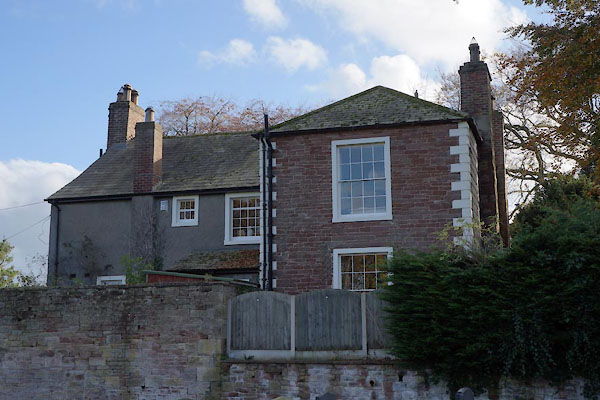 BZP32.jpg Rear. (taken 1.11.2013) |
||
|
|
||
| evidence:- | old map:- OS County Series (Cmd 29 4) placename:- Vicarage, The |
|
| source data:- | Maps, County Series maps of Great Britain, scales 6 and 25
inches to 1 mile, published by the Ordnance Survey, Southampton,
Hampshire, from about 1863 to 1948. |
|
|
|
||
| evidence:- | database:- Listed Buildings 2010 placename:- Old Vicarage |
|
| source data:- | courtesy of English Heritage "THE OLD VICARAGE / / CHURCH LANE / THURSBY / ALLERDALE / CUMBRIA / II / 71930 / NY3244250305" |
|
|
|
||
 Lakes Guides menu.