 Old Cumbria Gazetteer
 |
 |
|
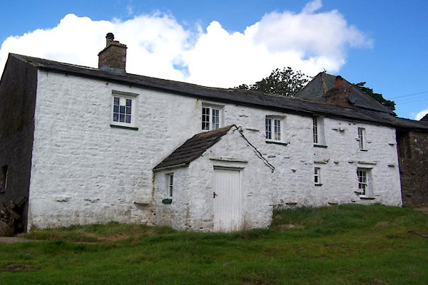
| New House, Ravenstonedale | ||
| New House | ||
| civil parish:- | Ravenstonedale (formerly Westmorland) | |
| county:- | Cumbria | |
| locality type:- | buildings | |
| coordinates:- | SD72509734 | |
| 1Km square:- | SD7297 | |
| 10Km square:- | SD79 | |
| references:- | Listed Buildings 2010 |
|
|
|
||
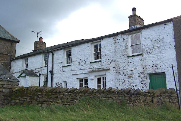 BXF89.jpg (taken 28.8.2012) 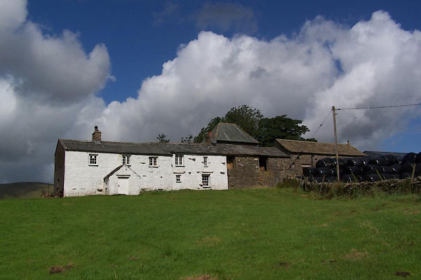 BXF91.jpg (taken 28.8.2012) |
||
|
|
||
| evidence:- | old map:- OS County Series (Wmd 36 9) placename:- New House placename:- House, New |
|
| source data:- | Maps, County Series maps of Great Britain, scales 6 and 25
inches to 1 mile, published by the Ordnance Survey, Southampton,
Hampshire, from about 1863 to 1948. |
|
|
|
||
| evidence:- | old map:- Jefferys 1770 (Wmd) placename:- New House |
|
| source data:- | Map, 4 sheets, The County of Westmoreland, scale 1 inch to 1
mile, surveyed 1768, and engraved and published by Thomas
Jefferys, London, 1770.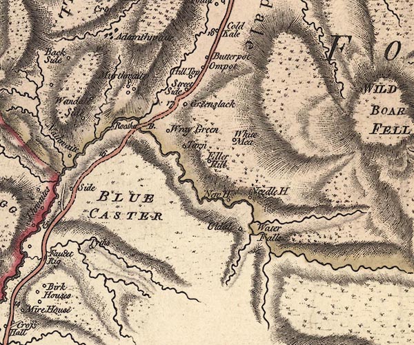 J5SD79NW.jpg "New H" circle, labelled in italic lowercase text; settlement, farm, house, or hamlet? item:- National Library of Scotland : EME.s.47 Image © National Library of Scotland |
|
|
|
||
| evidence:- | old map:- Cary 1789 (edn 1805) placename:- New House |
|
| source data:- | Map, uncoloured engraving, Westmoreland, scale about 2.5 miles
to 1 inch, by John Cary, London, 1789; edition 1805.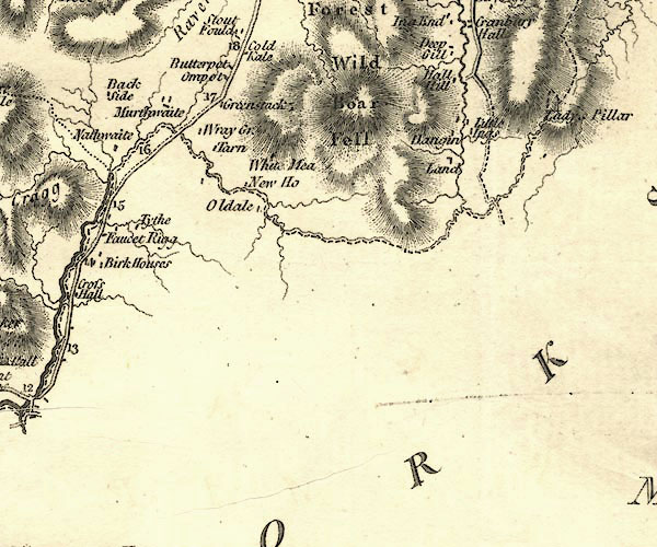 CY24SD79.jpg "New Ho" block/s, labelled in italic lowercase; house, or hamlet item:- JandMN : 129 Image © see bottom of page |
|
|
|
||
| evidence:- | database:- Listed Buildings 2010 placename:- New House item:- date stone (1914) |
|
| source data:- | courtesy of English Heritage "NEW HOUSE WITH ADJOINING COACH HOUSE AND BYRES / / / RAVENSTONEDALE / EDEN / CUMBRIA / II / 74100 / SD7250697349" |
|
|
|
||
 BXF90.jpg (taken 28.8.2012) |
||
|
|
||
 Lakes Guides menu.