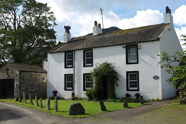


BVE94.jpg (taken 17.8.2011)
placename:- Muncaster House
placename:- Muncaster House
courtesy of English Heritage
"MUNCASTER HOUSE / / / SETMURTHY / ALLERDALE / CUMBRIA / II / 72750 / NY1473521017"
courtesy of English Heritage
"House, late C18 or early C19. Rendered rubble. Lakeland slate roof with stone ridge, gable copings and square kneelers, rendered end and off-centre chimneys. Possibly once house and cottage. Two storeys, one narrow and two wider bays. Right hand (house) part has central 6-panelled door in round-arched iron trellis porch. Replaced windows with thin glazing bars in painted stone surrounds. Rear elevation shows round-headed staircase window with Y-traceried head and small fire windows at left; other windows C19 sashes. Small pentice to rear, and other pent extensions, with added projections, at both ends, all of similar materials. Interior not seen."

 Lakes Guides menu.