 Old Cumbria Gazetteer
 |
 |
|
| maypole, Temple Sowerby | ||
| locality:- | Temple Sowerby | |
| civil parish:- | Temple Sowerby (formerly Westmorland) | |
| county:- | Cumbria | |
| locality type:- | maypole | |
| coordinates:- | NY61202700 | |
| 1Km square:- | NY6127 | |
| 10Km square:- | NY62 | |
|
|
||
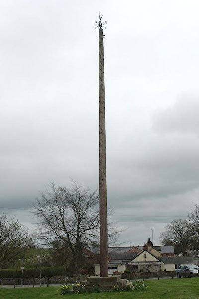 BWF18.jpg (taken 6.4.2012) 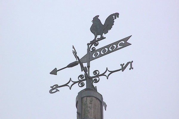 BNT13.jpg Weathervane on the maypole. (taken 30.5.2007) |
||
|
|
||
| evidence:- | old map:- OS County Series (Wmd 4 16) |
|
| source data:- | Maps, County Series maps of Great Britain, scales 6 and 25
inches to 1 mile, published by the Ordnance Survey, Southampton,
Hampshire, from about 1863 to 1948. "Maypole" |
|
|
|
||
| evidence:- | database:- Listed Buildings 2010 placename:- Maypole to South of the Cedars |
|
| source data:- | courtesy of English Heritage "MAYPOLE TO SOUTH OF THE CEDARS / / A66 / TEMPLE SOWERBY / EDEN / CUMBRIA / II / 424148 / NY6118727020" |
|
| source data:- | courtesy of English Heritage "Maypole, possibly on site of earlier cross. Mentioned in 1817 enclosure awards. 4 steps up, of millstone grit blocks. Timber upright is C20 replacement; wrought-iron weathervane is dated 1891." |
|
|
|
||
 Lakes Guides menu.