 Old Cumbria Gazetteer
 |
 |
|
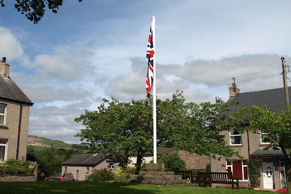
| maypole, Brough | ||
| Street:- | Square (The) | |
| locality:- | Church Brough | |
| locality:- | Brough | |
| civil parish:- | Brough (formerly Westmorland) | |
| county:- | Cumbria | |
| locality type:- | maypole | |
| locality type:- | cross | |
| coordinates:- | NY79401405 | |
| 1Km square:- | NY7914 | |
| 10Km square:- | NY71 | |
| SummaryText:- | Site of a cross | |
| references:- | Listed Buildings 2010 |
|
|
|
||
 BVC56.jpg (taken 29.7.2011) |
||
|
|
||
| evidence:- | old map:- OS County Series (Wmd 16 15) |
|
| source data:- | Maps, County Series maps of Great Britain, scales 6 and 25
inches to 1 mile, published by the Ordnance Survey, Southampton,
Hampshire, from about 1863 to 1948. "Cross" |
|
|
|
||
| evidence:- | database:- Listed Buildings 2010 |
|
| source data:- | courtesy of English Heritage "MAYPOLE ON FORMER CROSS BASE / / THE SQUARE / BROUGH / EDEN / CUMBRIA / II / 73310 / NY7940514055" |
|
| source data:- | courtesy of English Heritage "Former cross base of uncertain date but possibly medieval; refurbished C19/C20. 5 steps of large sandstone blocks, now supports maypole." |
|
|
|
||
 Lakes Guides menu.