 Old Cumbria Gazetteer
 |
 |
|
| Manor House, Burton-in-Kendal | ||
| Manor House | ||
| Street:- | Main Street | |
| locality:- | Burton-in-Kendal | |
| civil parish:- | Burton-in-Kendal (formerly Westmorland) | |
| county:- | Cumbria | |
| locality type:- | buildings | |
| coordinates:- | SD52987628 | |
| 1Km square:- | SD5276 | |
| 10Km square:- | SD57 | |
| references:- | Listed Buildings 2010 |
|
|
|
||
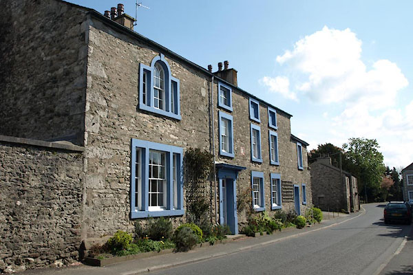 BWJ38.jpg (taken 6.5.2012) 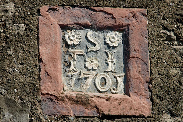 BWJ39.jpg Date stone:- "S / T I / 1701" (taken 6.5.2012) |
||
|
|
||
| evidence:- | old map:- OS County Series (Wmd 47 13) placename:- Manor House |
|
| source data:- | Maps, County Series maps of Great Britain, scales 6 and 25
inches to 1 mile, published by the Ordnance Survey, Southampton,
Hampshire, from about 1863 to 1948. |
|
|
|
||
| evidence:- | database:- Listed Buildings 2010 placename:- Manor House |
|
| source data:- | courtesy of English Heritage "MANOR HOUSE / / MAIN STREET / BURTON IN KENDAL / SOUTH LAKELAND / CUMBRIA / II / 76647 / SD5298976288" |
|
|
|
||
 Lakes Guides menu.