 Old Cumbria Gazetteer
 |
 |
|
| Manor Farm, Barrow-in-Furness | ||
| Manor Farm | ||
| Street:- | Rating Lane | |
| civil parish:- | Barrow-in-Furness (formerly Lancashire) | |
| county:- | Cumbria | |
| locality type:- | buildings | |
| coordinates:- | SD21477155 | |
| 1Km square:- | SD2171 | |
| 10Km square:- | SD27 | |
| references:- | Listed Buildings 2010 |
|
|
|
||
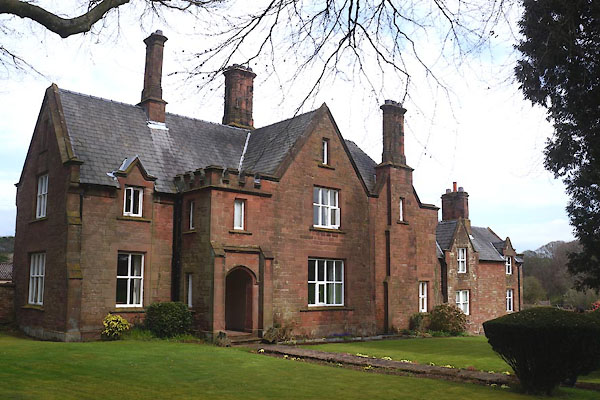 CCW54.jpg (taken 17.4.2015) |
||
|
|
||
| evidence:- | old map:- OS County Series (Lan 21 4) placename:- Manor House |
|
| source data:- | Maps, County Series maps of Great Britain, scales 6 and 25
inches to 1 mile, published by the Ordnance Survey, Southampton,
Hampshire, from about 1863 to 1948. |
|
|
|
||
| evidence:- | database:- Listed Buildings 2010 placename:- Manor Farm |
|
| source data:- | courtesy of English Heritage "MANOR FRAMHOUSE / / RATING LANE / BARROW IN FURNESS / BARROW IN FURNESS / CUMBRIA / II / 388569 / SD2147871558" |
|
|
|
||
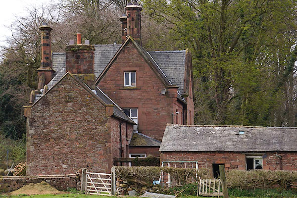 CCW55.jpg (taken 17.4.2015)  CCW56.jpg Barn. (taken 17.4.2015) |
||
|
|
||
 Lakes Guides menu.