 Old Cumbria Gazetteer
 |
 |
|
| Mains Farm, Barton | ||
| Mains Farm | ||
| civil parish:- | Barton (formerly Westmorland) | |
| county:- | Cumbria | |
| locality type:- | buildings | |
| coordinates:- | NY47582459 | |
| 1Km square:- | NY4724 | |
| 10Km square:- | NY42 | |
| references:- | Listed Buildings 2010 |
|
|
|
||
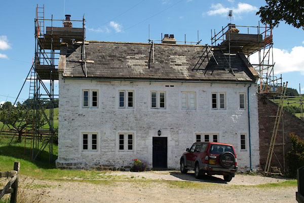 BXB42.jpg (taken 10.8.2012) 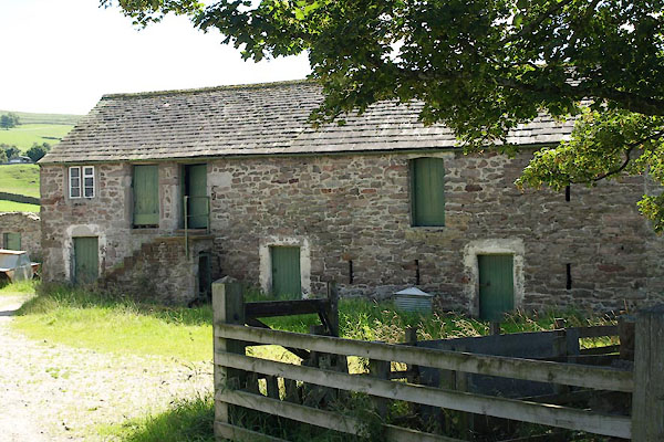 BXB43.jpg Barn. (taken 10.8.2012) |
||
|
|
||
| evidence:- | old map:- OS County Series (Wmd 7 6) placename:- Mainshouse |
|
| source data:- | Maps, County Series maps of Great Britain, scales 6 and 25
inches to 1 mile, published by the Ordnance Survey, Southampton,
Hampshire, from about 1863 to 1948. |
|
|
|
||
| evidence:- | database:- Listed Buildings 2010 placename:- Mains Farm |
|
| source data:- | courtesy of English Heritage "MAINS FARMHOUSE / / B5320 / BARTON / EDEN / CUMBRIA / II / 74502 / NY4758724595" |
|
|
|
||
| evidence:- | database:- Listed Buildings 2010 |
|
| source data:- | courtesy of English Heritage "BARN IMMEDIATELY NORTH OF MAINS FARMHOUSE / / B5320 / BARTON / EDEN / CUMBRIA / II / 74503 / NY4758124620" |
|
|
|
||
| evidence:- | database:- Listed Buildings 2010 |
|
| source data:- | courtesy of English Heritage "FARM BUILDING IMMEDIATELY TO SOUTHWEST OF MAINS FARMHOUSE / / B5320 / BARTON / EDEN / CUMBRIA / II / 74504 / NY4756624579" |
|
|
|
||
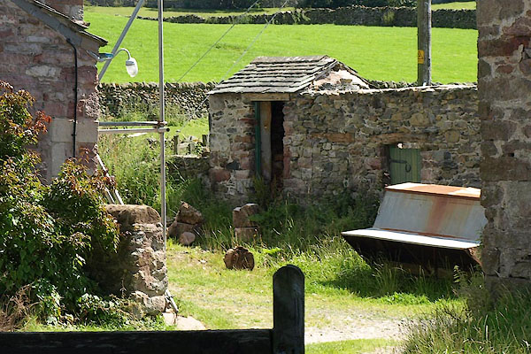 BXB44.jpg Privy? (taken 10.8.2012) |
||
|
|
||
 Lakes Guides menu.