 Old Cumbria Gazetteer
 |
 |
|
| Low Whinhowe, Bretherdale | ||
| Low Whinhowe | ||
| locality:- | Bretherdale | |
| civil parish:- | Orton S (formerly Westmorland) | |
| county:- | Cumbria | |
| locality type:- | buildings | |
| coordinates:- | NY59350542 | |
| 1Km square:- | NY5905 | |
| 10Km square:- | NY50 | |
| references:- | Listed Buildings 2010 |
|
|
|
||
| evidence:- | old map:- OS County Series (Wmd 28 7) placename:- Low Whinhowe placename:- Whinhowe, Low |
|
| source data:- | Maps, County Series maps of Great Britain, scales 6 and 25
inches to 1 mile, published by the Ordnance Survey, Southampton,
Hampshire, from about 1863 to 1948. |
|
|
|
||
| evidence:- | old map:- Jefferys 1770 (Wmd) placename:- Whinhow |
|
| source data:- | Map, 4 sheets, The County of Westmoreland, scale 1 inch to 1
mile, surveyed 1768, and engraved and published by Thomas
Jefferys, London, 1770.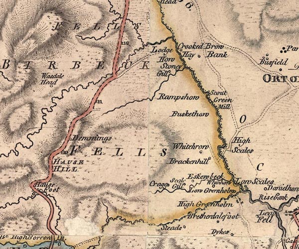 J5NY50NE.jpg "Whinhow" circle, labelled in italic lowercase text; settlement, farm, house, or hamlet? item:- National Library of Scotland : EME.s.47 Image © National Library of Scotland |
|
|
|
||
| evidence:- | database:- Listed Buildings 2010 placename:- Low Whinhowe Farm |
|
| source data:- | courtesy of English Heritage "LOW WHINHOWE FARMHOUSE AND ADJOINING STORE / / / ORTON / EDEN / CUMBRIA / II / 74095 / NY5935805424" |
|
|
|
||
 Lakes Guides menu.