 Old Cumbria Gazetteer
 |
 |
|
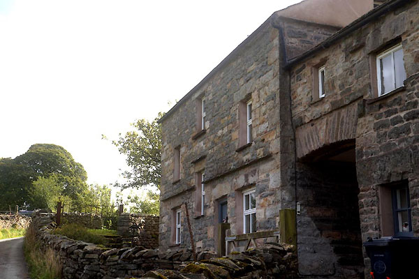
| Low Hollins Farm, Frostrow | ||
| Low Hollins Farm | ||
| Street:- | Frostrow Lane | |
| civil parish:- | Sedbergh (formerly Yorkshire) | |
| county:- | Cumbria | |
| locality type:- | buildings | |
| coordinates:- | SD67379123 | |
| 1Km square:- | SD6791 | |
| 10Km square:- | SD69 | |
| references:- | Listed Buildings 2010 |
|
|
|
||
 CDZ48.jpg (taken 25.9.2015) |
||
|
|
||
| evidence:- | old map:- OS County Series (Yrk 63 4) placename:- Low Hollins placename:- Hollins, Low |
|
| source data:- | Maps, County Series maps of Great Britain, scales 6 and 25
inches to 1 mile, published by the Ordnance Survey, Southampton,
Hampshire, from about 1863 to 1948. |
|
|
|
||
| evidence:- | database:- Listed Buildings 2010 placename:- Low Hollins Farm |
|
| source data:- | courtesy of English Heritage "LOW HOLLINS FARMHOUSE AND ATTACHED GARDEN WALL / / FROSTROW LANE / SEDBERGH / SOUTH LAKELAND / CUMBRIA / II / 484559 / SD6737491233" |
|
|
|
||
| evidence:- | database:- Listed Buildings 2010 |
|
| source data:- | courtesy of English Heritage "BARN ATTACHED TO WEST SIDE OF LOW HOLLINS FARMHOUSE / / FROSTROW LANE / SEDBERGH / SOUTH LAKELAND / CUMBRIA / II / 484560 / SD6736291237" |
|
|
|
||
 Lakes Guides menu.