 Old Cumbria Gazetteer
 |
 |
|
| Lindsey Fold Farm, Garsdale | ||
| Lindsey Fold Farm | ||
| Street:- | Hawes Road | |
| civil parish:- | Garsdale (formerly Yorkshire) | |
| county:- | Cumbria | |
| locality type:- | buildings | |
| coordinates:- | SD71539095 | |
| 1Km square:- | SD7190 | |
| 10Km square:- | SD79 | |
| references:- | Listed Buildings 2010 |
|
|
|
||
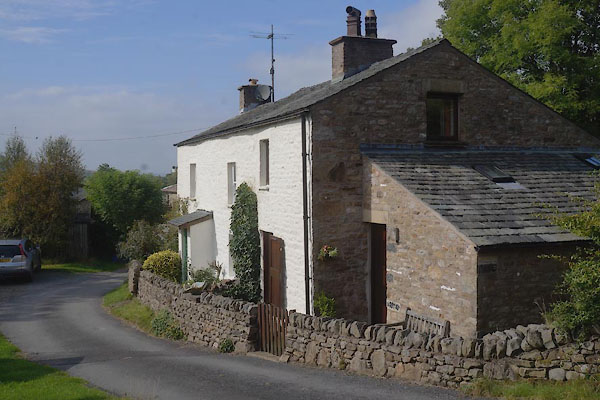 CBS72.jpg (taken 19.9.2014) |
||
|
|
||
| evidence:- | old map:- OS County Series (Yrk 64 2) placename:- Lindsey Fold |
|
| source data:- | Maps, County Series maps of Great Britain, scales 6 and 25
inches to 1 mile, published by the Ordnance Survey, Southampton,
Hampshire, from about 1863 to 1948. |
|
|
|
||
| evidence:- | database:- Listed Buildings 2010 placename:- Lindsey Fold Farm item:- spice cupboard |
|
| source data:- | courtesy of English Heritage "LINDSEY FOLD FARMHOUSE / / HAWES ROAD / GARSDALE / SOUTH LAKELAND / CUMBRIA / II / 484463 / SD7153690956" |
|
|
|
||
 Lakes Guides menu.