 Old Cumbria Gazetteer
 |
 |
|
| limekiln, Ravenstonedale (4) | ||
| Street:- | Church Gate | |
| locality:- | Will Hill | |
| civil parish:- | Ravenstonedale (formerly Westmorland) | |
| county:- | Cumbria | |
| locality type:- | buildings | |
| coordinates:- | NY70520441 | |
| 1Km square:- | NY7004 | |
| 10Km square:- | NY70 | |
| references:- | Listed Buildings 2010 |
|
|
|
||
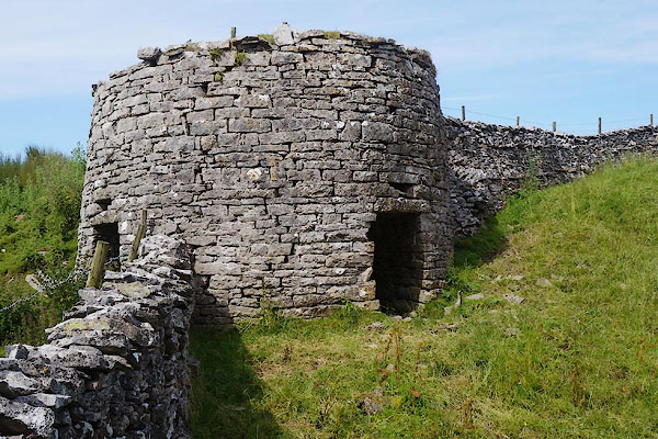 CBB23.jpg (taken 11.7.2014) 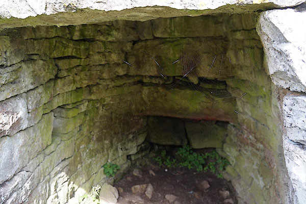 CBB25.jpg Eye hole. (taken 11.7.2014) |
||
|
|
||
| evidence:- | old map:- OS County Series (Wmd 29 8) |
|
| source data:- | Maps, County Series maps of Great Britain, scales 6 and 25
inches to 1 mile, published by the Ordnance Survey, Southampton,
Hampshire, from about 1863 to 1948. "Limekiln" |
|
|
|
||
| evidence:- | database:- Listed Buildings 2010 |
|
| source data:- | courtesy of English Heritage "LIME KILN 250 YARDS TO SOUTH WEST OF BECKSTONES FARMHOUSE (AT NGR 705 044) / / CHURCH GATE / RAVENSTONEDALE / EDEN / CUMBRIA / II / 74122 / NY7050004400" |
|
| source data:- | courtesy of English Heritage "Lime Kiln. Probably C18. Coursed, squared rubble; drystone construction. Circular in plan c.12 ft high with ramp leading from south side up to top. Hearth opening to south-east, c.5 ft high with splayed sides." |
|
|
|
||
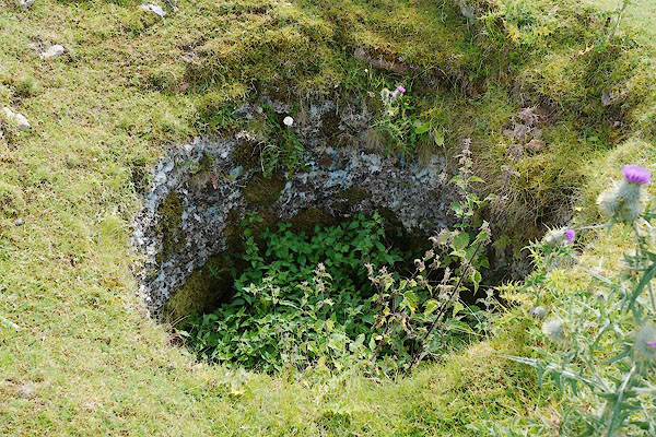 CBB26.jpg Feed hole at top. (taken 11.7.2014) 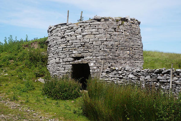 CBB24.jpg (taken 11.7.2014) |
||
|
|
||
 Lakes Guides menu.