 Old Cumbria Gazetteer
 |
 |
|
| limekiln, Grange-over-Sands | ||
| Street:- | Hampsfell Road | |
| civil parish:- | Grange-over-Sands (formerly Lancashire) | |
| county:- | Cumbria | |
| locality type:- | limekiln | |
| coordinates:- | SD40817826 | |
| 1Km square:- | SD4078 | |
| 10Km square:- | SD47 | |
| references:- | Listed Buildings 2010 |
|
|
|
||
 CBF48.jpg (taken 23.7.2014) 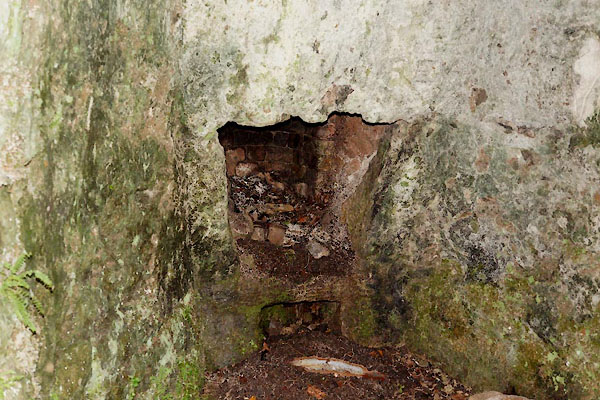 CBF49.jpg (taken 23.7.2014) |
||
|
|
||
| evidence:- | database:- Listed Buildings 2010 |
|
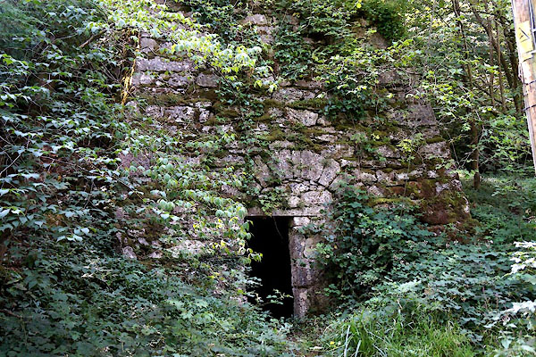
| source data:- | courtesy of English Heritage "KILN AT SD 4082 7826 TO THE EAST OF HILLSIDE COTTAGE AND TO THE SOUTH OF SANDYFIELD / / HAMPSFELL ROAD / GRANGE OVER SANDS / SOUTH LAKELAND / CUMBRIA / II / 460518 / SD4081978268" |
|
| source data:- | courtesy of English Heritage "Limekiln. Probably early C19. Limestone rubble with brick lining. Of roughly square plan, built into the hillside, with battered sides. At the lower level there is a chamber with a segmental vault. At the rear the brick kiln lining is visible through a stoke hole. The entrance to the lower chamber is partly blocked by a rubble wall which contains a doorway with a stone lintel." |
|
|
|
||
 Lakes Guides menu.