 Old Cumbria Gazetteer
 |
 |
|
| lighthouse, Maryport Harbour | ||
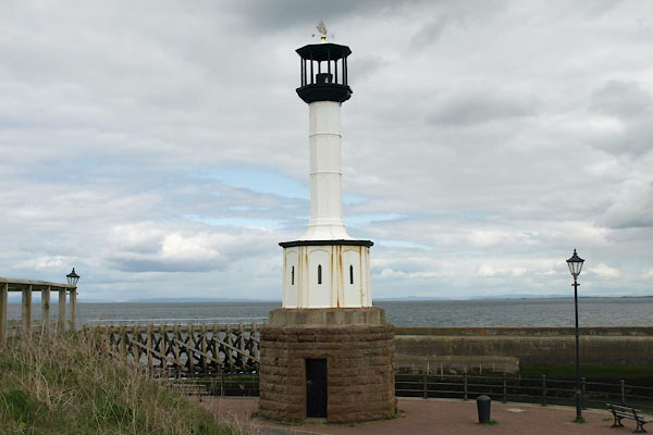
| site name:- | Maryport Harbour | |
| Street:- | South Pier | |
| civil parish:- | Maryport (formerly Cumberland) | |
| county:- | Cumbria | |
| locality type:- | lighthouse | |
| coordinates:- | NY02983681 | |
| 1Km square:- | NY0236 | |
| 10Km square:- | NY03 | |
| references:- | Listed Buildings 2010 |
|
|
|
||
 BWI29.jpg (taken 4.5.2012) 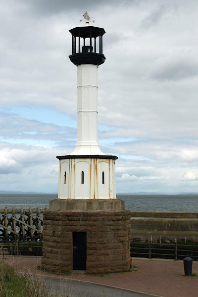 BWI28.jpg (taken 4.5.2012) |
||
|
|
||
| evidence:- | old map:- OS County Series (Cmd 44 8) |
|
| source data:- | Maps, County Series maps of Great Britain, scales 6 and 25
inches to 1 mile, published by the Ordnance Survey, Southampton,
Hampshire, from about 1863 to 1948. "Lighthouse" on South Pier |
|
|
|
||
| evidence:- | database:- Listed Buildings 2010 placename:- Lighthouse, The |
|
| source data:- | courtesy of English Heritage "THE LIGHTHOUSE / / THE HARBOUR (SOUTH PIER) / MARYPORT / ALLERDALE / CUMBRIA / II / 71863 / NY0298536811" |
|
| source data:- | courtesy of English Heritage "Circa 1846. Probably the oldest cast iron lighthouse in Britain. Disused. About 36 feet high. On tall plinth of russicated stone with a flattened Tudor arched panel in each face (one open) and a cornice; the latter supports an octagonal column with stepped splayed base, crowned by an octagonal lantern with flat capping, finial and vane. Included mainly for historic interest, as the precursor of a lighthouse type." |
|
|
|
||
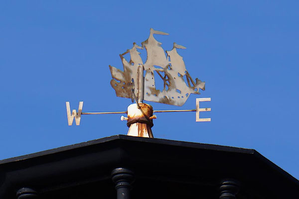 CFN92.jpg Weathervane. (taken 30.9.2016)  BNS25.jpg Harbour light. (taken 25.5.2007) |
||
|
|
||
 Lakes Guides menu.