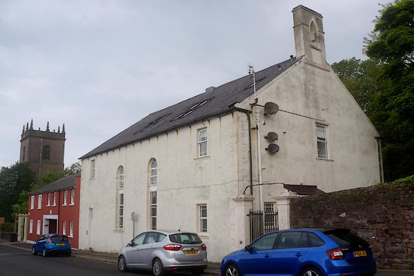


CFB31.jpg (taken 27.5.2016)
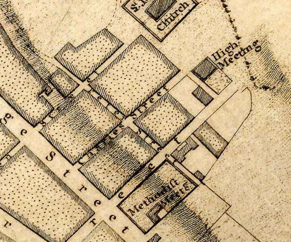
"U. P. Church / Grave Yard"
placename:- High Meeting

D49718R.jpg
"High Meeting"
building
item:- Carlisle Library : Map 2
Image © Carlisle Library
courtesy of English Heritage
"THE KIRK MISSION HALL, GATEPIERS AND ATTACHED BOUNDARY WALL / / HIGH STREET / WHITEHAVEN / COPELAND / CUMBRIA / II / 429161 / NX9772518374"
courtesy of English Heritage
"Non conformist church, now redundant. Mid C18, with C19 and C20 alterations. Rubble sandstone, brought to courses, with ashlar dressings, and roughcast rendered in part, or wholly in all elevations. Welsh-slated roof, with stone copings to south-west gable. South-west elevation; two storeys, four bays, the two centre bays unfloored, the south east bay with the kirk gallery. Tall semi- circular arch headed window openings to centre bays, with unmoulded imposts and keyblocks, and projecting cills. North-east bay with ground-floor doorway and rectangular overlight, below a rectangular first-floor window opening. All openings are set within plain ashlar surrounds, and are blocked by temporary shuttering. Window frames, visible from interior were apparently sashes with margin glazing. South-east end bay with stacked rectangular windows. South-west gable with double doorways to each side, with 3 panels to each door. Rectangular gallery window to gable apex, now blocked, with flat- topped bellcote above, with single pointed arch-headed bell opening. Interior much altered, but with vestibule wall, single doorways to meeting room, and gallery with two tapered octagonal column supports. Gallery front with cornice and top rail above field rectangular panels, and frieze with alternate Greek Key and triglyph decoration below a lower cornice. Glazed moveable screen made up of 6-pane lights set above. Some late C20 temporary partitioning below. North- west end with C19 partitioning, and a tiered platform with two parallel flights of steps flanking a winged reading desk, with rectangular fielded panels except those to the three facets of the pulpit with curved heads to the upper panels. C18 rectangular panelling to right-hand side and to rear wall of tiered platform. Painted band to wall head with inscription in Lombardic script. The Kirk was originally the church of Whitehaven's Scots Presbyterians before becoming a methodist house in the late C19. The building is identified as 'High Meeting' in J. Howards survey of Whitehaven of 1790. Plain gatepiers, square on plan, with oversailing caps, and rubble stone boundary wall, with saddleback coping, which encloses burial ground to south east of Kirk."

 Lakes Guides menu.