 Old Cumbria Gazetteer
 |
 |
|
| house, Kingbridge Ford | ||
| locality:- | Kingbridge Ford | |
| civil parish:- | Kingwater (formerly Cumberland) | |
| county:- | Cumbria | |
| locality type:- | buildings | |
| locality type:- | inn (ex) | |
| coordinates:- | NY57776750 | |
| 1Km square:- | NY5767 | |
| 10Km square:- | NY56 | |
| references:- | Listed Buildings 2010 |
|
|
|
||
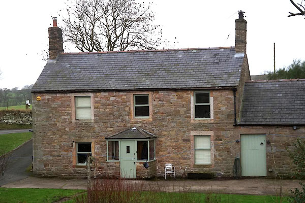 CEN01.jpg (taken 25.1.2016) |
||
|
|
||
| evidence:- | old map:- OS County Series (Cmd 12 7) placename:- Blacksmith's Arms |
|
| source data:- | Maps, County Series maps of Great Britain, scales 6 and 25
inches to 1 mile, published by the Ordnance Survey, Southampton,
Hampshire, from about 1863 to 1948. "Blacksmith's Arms / P.H" |
|
|
|
||
| evidence:- | database:- Listed Buildings 2010 placename:- Kingsbridge Ford item:- date stone (1753) |
|
| source data:- | courtesy of English Heritage "KINGSBRIDGE FORD AND ADJOINING OUTBUILDING / / / KINGWATER / CARLISLE / CUMBRIA / II / 78147 / NY5777967498" |
|
|
|
||
 Lakes Guides menu.