 Old Cumbria Gazetteer
 |
 |
|
| Camp House, Rosley | ||
| Camp House | ||
| locality:- | Rosley | |
| civil parish:- | Westward (formerly Cumberland) | |
| county:- | Cumbria | |
| locality type:- | buildings | |
| locality type:- | inn (ex) | |
| coordinates:- | NY31824560 | |
| 1Km square:- | NY3145 | |
| 10Km square:- | NY34 | |
| references:- | Listed Buildings 2010 |
|
|
|
||
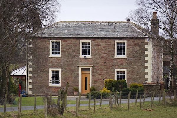 CET14.jpg (taken 18.3.2016) |
||
|
|
||
| evidence:- | old map:- OS County Series (Cmd 29 16) placename:- Camp House |
|
| source data:- | Maps, County Series maps of Great Britain, scales 6 and 25
inches to 1 mile, published by the Ordnance Survey, Southampton,
Hampshire, from about 1863 to 1948. "Camp House (P.H.)" on the north corner of the fair ground. |
|
|
|
||
| evidence:- | old map:- Donald 1774 (Cmd) placename:- Camp House |
|
| source data:- | Map, hand coloured engraving, 3x2 sheets, The County of Cumberland, scale about 1
inch to 1 mile, by Thomas Donald, engraved and published by Joseph Hodskinson, 29
Arundel Street, Strand, London, 1774.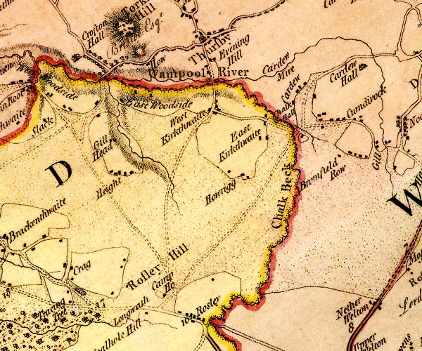 D4NY34NW.jpg "Camp Ho." block or blocks, labelled in lowercase; a hamlet or just a house item:- Carlisle Library : Map 2 Image © Carlisle Library |
|
|
|
||
| evidence:- | database:- Listed Buildings 2010 placename:- Hope and Anchor Inn |
|
| source data:- | courtesy of English Heritage "HOPE AND ANCHOR INN / / / WESTWARD / ALLERDALE / CUMBRIA / II / 72511 / NY3182645575" |
|
| source data:- | courtesy of English Heritage "Public House. Early C19. Coursed red sandstone rubble with raised painted quoins. Graduated hipped greenslate roof with stone chimney stacks. 2 storeys, 3 bays with 2-bay extension to rear forming overall T-shape. C20 door with fanlight in painted stone surround under cornice. Sash windows with glazing bars in painted stone surrounds. Extension of similar details. Set well back from the road, as this was beside the field used for the Rosley cattle fairs." |
|
|
|
||
 Lakes Guides menu.