 Old Cumbria Gazetteer
 |
 |
|
| Holmhill Farm, Dalston | ||
| Holmhill Farm | ||
| civil parish:- | Dalston (formerly Cumberland) | |
| county:- | Cumbria | |
| locality type:- | buildings | |
| coordinates:- | NY37504746 | |
| 1Km square:- | NY3747 | |
| 10Km square:- | NY34 | |
| references:- | Listed Buildings 2010 |
|
|
|
||
| evidence:- | old map:- OS County Series (Cmd 30 10) placename:- Homehill Farm |
|
| source data:- | Maps, County Series maps of Great Britain, scales 6 and 25
inches to 1 mile, published by the Ordnance Survey, Southampton,
Hampshire, from about 1863 to 1948. |
|
|
|
||
| evidence:- | possibly old map:- Donald 1774 (Cmd) |
|
| source data:- | Map, hand coloured engraving, 3x2 sheets, The County of Cumberland, scale about 1
inch to 1 mile, by Thomas Donald, engraved and published by Joseph Hodskinson, 29
Arundel Street, Strand, London, 1774.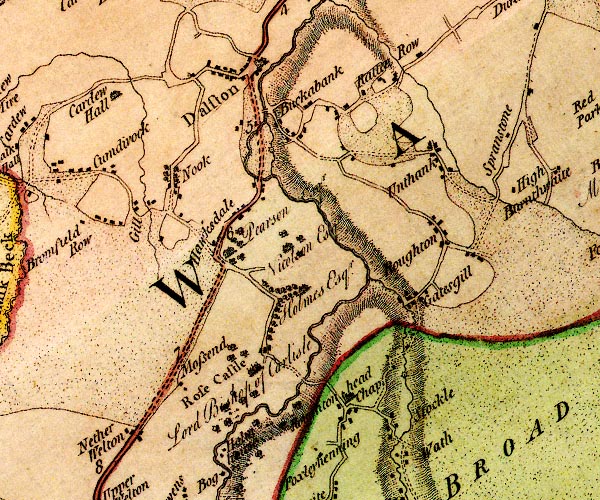 D4NY34NE.jpg "Pearson Esqr." house at Hawksdale item:- Carlisle Library : Map 2 Image © Carlisle Library |
|
|
|
||
| evidence:- | database:- Listed Buildings 2010 placename:- Holmmill Farm |
|
| source data:- | courtesy of English Heritage "HOLMMILL FARMHOUSE / / / DALSTON / CARLISLE / CUMBRIA / II / 78326 / NY3750747462" |
|
|
|
||
 Lakes Guides menu.