 Old Cumbria Gazetteer
 |
 |
|
| High Cark Hall, Staveley-in-Cartmel | ||
| High Cark Hall | ||
| civil parish:- | Staveley-in-Cartmel (formerly Lancashire) | |
| county:- | Cumbria | |
| locality type:- | buildings | |
| coordinates:- | SD37988239 | |
| 1Km square:- | SD3782 | |
| 10Km square:- | SD38 | |
| references:- | Listed Buildings 2010 |
|
|
|
||
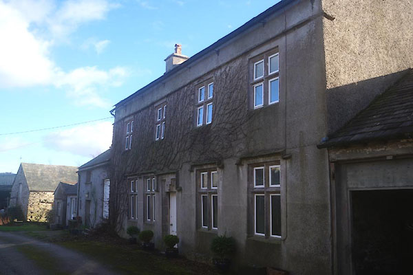 CEO47.jpg (taken 10.2.2016) 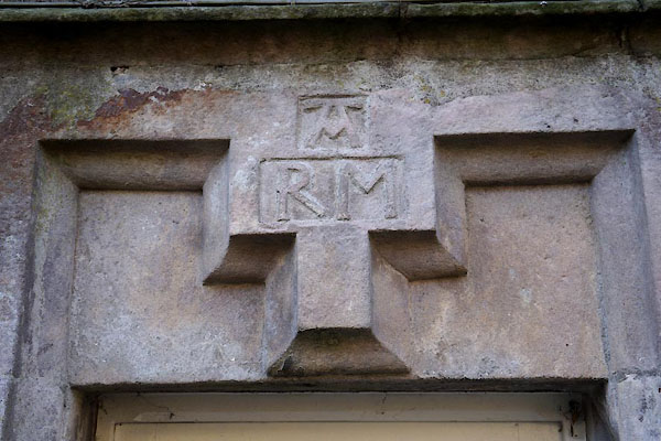 CEO48.jpg Date stone, no date:- "A / R M" (taken 10.2.2016) |
||
|
|
||
| evidence:- | old map:- OS County Series (Lan 12 7) placename:- High Cark Hall placename:- Cark Hall, High |
|
| source data:- | Maps, County Series maps of Great Britain, scales 6 and 25
inches to 1 mile, published by the Ordnance Survey, Southampton,
Hampshire, from about 1863 to 1948. |
|
|
|
||
| evidence:- | database:- Listed Buildings 2010 placename:- High Clark Hall |
|
| source data:- | courtesy of English Heritage "HIGH CLARK HALL / / / STAVELEY IN CARTMEL / SOUTH LAKELAND / CUMBRIA / II / 421933 / SD3798182395" |
|
|
|
||
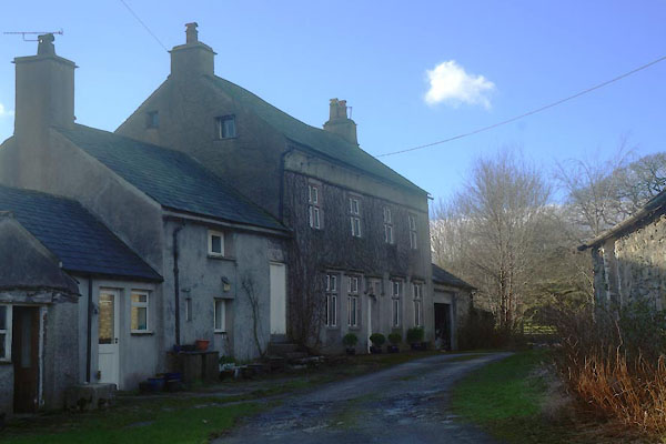 CEO46.jpg (taken 10.2.2016) |
||
|
|
||
 Lakes Guides menu.