 Old Cumbria Gazetteer
 |
 |
|
| Hawkrigg, Firbank | ||
| Hawkrigg | ||
| civil parish:- | Firbank (formerly Westmorland) | |
| county:- | Cumbria | |
| locality type:- | buildings | |
| coordinates:- | SD62459200 | |
| 1Km square:- | SD6292 | |
| 10Km square:- | SD69 | |
| references:- | Listed Buildings 2010 |
|
|
|
||
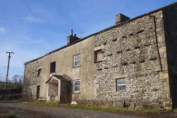 CEN51.jpg (taken 29.1.2016)  CEN52.jpg Porch. (taken 29.1.2016) |
||
|
|
||
| evidence:- | old map:- OS County Series (Wmd 39 8) placename:- Hawkrigg End |
|
| source data:- | Maps, County Series maps of Great Britain, scales 6 and 25
inches to 1 mile, published by the Ordnance Survey, Southampton,
Hampshire, from about 1863 to 1948. |
|
|
|
||
| evidence:- | database:- Listed Buildings 2010 placename:- Hawkrigg |
|
| source data:- | courtesy of English Heritage "HAWKRIGG AND ADJOINING OUTBUILDINGS / / A684 / FIRBANK / SOUTH LAKELAND / CUMBRIA / II / 75642 / SD6245492001" |
|
|
|
||
 Lakes Guides menu.