 Old Cumbria Gazetteer
 |
 |
|
| Greenbank Farm, Green Bank | ||
| Greenbank Farm | ||
| Street:- | Aynsome Lane | |
| locality:- | Green Bank | |
| civil parish:- | Broughton East (formerly Lancashire) | |
| county:- | Cumbria | |
| locality type:- | buildings | |
| coordinates:- | SD38078036 | |
| 1Km square:- | SD3880 | |
| 10Km square:- | SD38 | |
| references:- | Listed Buildings 2010 |
|
|
|
||
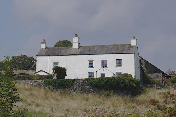 CDW87.jpg (taken 11.9.2015) |
||
|
|
||
| evidence:- | old map:- OS County Series (Lan 12 15) placename:- Greenbank Farm |
|
| source data:- | Maps, County Series maps of Great Britain, scales 6 and 25
inches to 1 mile, published by the Ordnance Survey, Southampton,
Hampshire, from about 1863 to 1948. |
|
|
|
||
| evidence:- | database:- Listed Buildings 2010 placename:- Greenbank Farm item:- date stone (1663) |
|
| source data:- | courtesy of English Heritage "GREENBANK FARMHOUSE AND COTTAGE / / AYNSOME LANE / BROUGHTON EAST / SOUTH LAKELAND / CUMBRIA / II / 76913 / SD3807980361" |
|
|
|
||
 Lakes Guides menu.