 Old Cumbria Gazetteer
 |
 |
|
| Eastwood House, Barrow-in-Furness | ||
| Eastwood House | ||
| Street:- | Rampside Road | |
| civil parish:- | Barrow-in-Furness (formerly Lancashire) | |
| county:- | Cumbria | |
| locality type:- | buildings | |
| coordinates:- | SD24136667 | |
| 1Km square:- | SD2466 | |
| 10Km square:- | SD26 | |
| references:- | Listed Buildings 2010 |
|
|
|
||
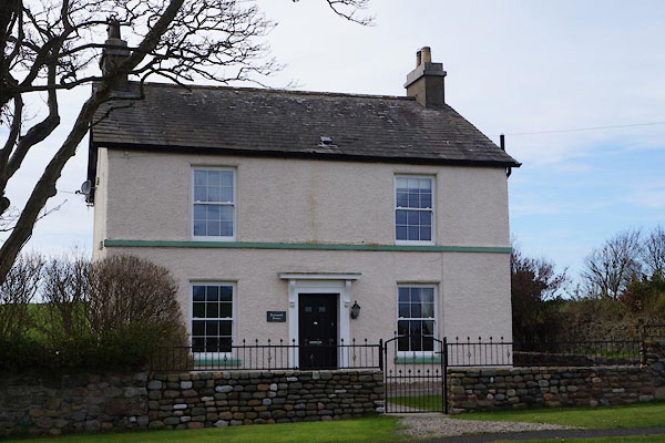 CAG33.jpg (taken 4.4.2014) |
||
|
|
||
| evidence:- | old map:- OS County Series (Lan 22 13) placename:- Eastwood House |
|
| source data:- | Maps, County Series maps of Great Britain, scales 6 and 25
inches to 1 mile, published by the Ordnance Survey, Southampton,
Hampshire, from about 1863 to 1948. |
|
|
|
||
| evidence:- | database:- Listed Buildings 2010 placename:- Eastwood House |
|
| source data:- | courtesy of English Heritage "EASATWOOD HOUSE / / RAMPSIDE ROAD / BARROW IN FURNESS / BARROW IN FURNESS / CUMBRIA / II / 388565 / SD2413466679" |
|
|
|
||
 Lakes Guides menu.