 Old Cumbria Gazetteer
 |
 |
|
| Dubmill Swap, Solway Firth | ||
| Dubmill Swap | ||
| site name:- | Solway Firth | |
| locality:- | ||
| civil parish:- | Holme St Cuthbert (formerly Cumberland) (off) | |
| county:- | Cumbria | |
| locality type:- | sandbank | |
| 1Km square:- | NY0747 (etc etc) | |
| 10Km square:- | NY04 | |
|
|
||
| evidence:- | old text:- Gents Mag placename:- Swap, The item:- leading line |
|
| source data:- | Magazine, The Gentleman's Magazine or Monthly Intelligencer or
Historical Chronicle, published by Edward Cave under the
pseudonym Sylvanus Urban, and by other publishers, London,
monthly from 1731 to 1922. goto source goto sourceGentleman's Magazine 1748 p.291 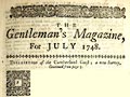 click to enlarge click to enlargeG748E04.jpg "... When Howmichael chapel and the saddle on Bees head are in one line, you may avoid the Swap; and when Dubmill-house and mount Skiddow are in a line, you are on the tail of Dubmill swap, and so may turn down the Salway; 'tis about half a mile broad." |
|
|
|
||
| evidence:- | old text:- Mackenzie 1776 placename:- Dubmill Swap |
|
| source data:- | Charts, and sailing directions, Nautical Descriptions of the
West Coast of Great Britain, Bristol Channel to Cape Wrath, by
Murdoch Mackenzie, published London, 1776. goto source Pages 23-24:- "... ..." "Dubmill-swap is a broad sand between Allonby and Beckfoot, which extends about two miles from the shore; the outer end of it dries with spring-tide only: there are two rocks on it that dry about half-ebb; one of which lies about a mile from Dubmill Point, the other half a mile. When Helton Castle is on the E. end of Allonby, you are then near the S. side of Dubmill-swap. There is a channel near the shore, in which there is a foot or two of water at low spring-tide. To avoid the extremity of this sand; keep St. Bee's Head a ship's-length without How-michael; or keep Silloth Point and Hairly Hill in a line: Hairly Hill is a small top of a Hill by itself, tapering regularly, and the farthest visible. When Beckfoot bears S.E. you are a little eastward of it; then, to avoid Silloth Bank, steer in nearer the shore." |
|
|
|
||
Lakes Guides menu.