 Old Cumbria Gazetteer
 |
 |
|
| Currick, Bewcastle | ||
| civil parish:- | Bewcastle (formerly Cumberland) | |
| county:- | Cumbria | |
| locality type:- | earthwork | |
| locality type:- | currick (doubtful) | |
| coordinates:- | NY53728277 | |
| 1Km square:- | NY5382 | |
| 10Km square:- | NY58 | |
| SummaryText:- | a 'long cairn' ? | |
|
|
||
| evidence:- | old map:- OS County Series (Cmd 4 1) placename:- Currick |
|
| source data:- | Maps, County Series maps of Great Britain, scales 6 and 25
inches to 1 mile, published by the Ordnance Survey, Southampton,
Hampshire, from about 1863 to 1948. |
|
|
|
||
| evidence:- | perhaps site plan:- KSH 1930s placename:- Currick, The |
|
| source data:- | Site plan, ms ink on card, The Currick, Bewcastle, Cumberland,
scale about 1 to 240, by K S Hodgson, 1935.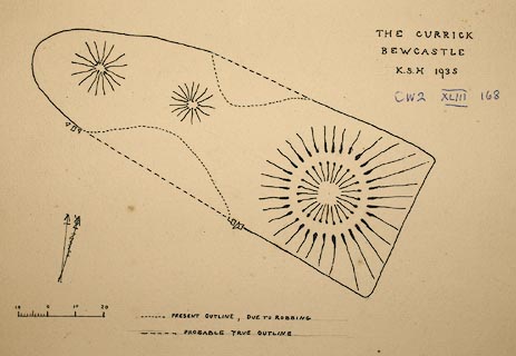 click to enlarge click to enlargeM042.jpg item:- Carlisle Library : Map 302 Image © Carlisle Library |
|
|
|
||
 Lakes Guides menu.