 Old Cumbria Gazetteer
 |
 |
|
| Crosby House, High Crosby | ||
| out of sight | ||
| Crosby House | ||
| locality:- | High Crosby | |
| civil parish:- | Stanwix Rural (formerly Cumberland) | |
| county:- | Cumbria | |
| locality type:- | buildings | |
| coordinates:- | NY45565969 | |
| 1Km square:- | NY4559 | |
| 10Km square:- | NY45 | |
| references:- | Listed Buildings 2010 |
|
|
|
||
| evidence:- | old map:- OS County Series (Cmd 17 10) placename:- Crosby House |
|
| source data:- | Maps, County Series maps of Great Britain, scales 6 and 25
inches to 1 mile, published by the Ordnance Survey, Southampton,
Hampshire, from about 1863 to 1948. |
|
|
|
||
| evidence:- | database:- Listed Buildings 2010 placename:- Crosby House |
|
| source data:- | courtesy of English Heritage "CROSBY HOUSE / / / STANWIX RURAL / CARLISLE / CUMBRIA / II / 77649 / NY4558059696" |
|
|
|
||
| evidence:- | database:- Listed Buildings 2010 |
|
| source data:- | courtesy of English Heritage "GATE PIERS TO NORTH OF CROSBY HOUSE / / / STANWIX RURAL / CARLISLE / CUMBRIA / II / 77650 / NY4553259730" |
|
|
|
||
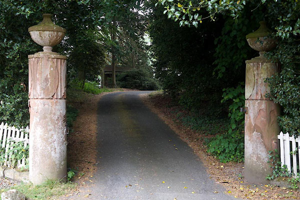 CFC28.jpg Gate piers. (taken 10.6.2016) 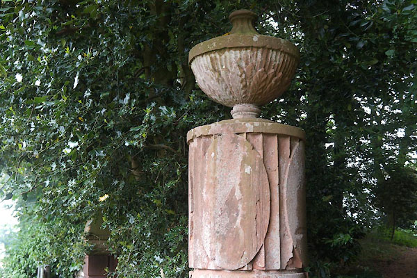 CFC29.jpg Gate piers. (taken 10.6.2016) |
||
|
|
||
 Lakes Guides menu.