 Old Cumbria Gazetteer
 |
 |
|
| chapel, Workington (3) | ||
| United Church | ||
| Street:- | William Street | |
| locality:- | Workington | |
| civil parish:- | Workington (formerly Cumberland) | |
| county:- | Cumbria | |
| locality type:- | chapel | |
| coordinates:- | NY00122886 | |
| 1Km square:- | NY0028 | |
| 10Km square:- | NY02 | |
|
|
||
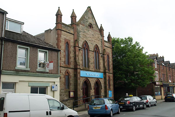 BUO38.jpg (taken 13.5.2011) |
||
|
|
||
| evidence:- | old map:- OS County Series (Cmd 53 11) |
|
| source data:- | Maps, County Series maps of Great Britain, scales 6 and 25
inches to 1 mile, published by the Ordnance Survey, Southampton,
Hampshire, from about 1863 to 1948. "Independent Ch. (Congregational)" on South William Street? |
|
|
|
||
| evidence:- | old map:- Howard 1790s (town-Wrkn) placename:- Low Meeting House |
|
| source data:- | Town plan, uncoloured engraving, Plan of the Town and Harbour of
Workington, scale about 16 inches to 1 mile, probably by J
Howard, 1793, published by F Jollie and Sons, Carlisle,
Cumberland, 1811. "Low Meeting House" 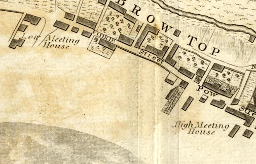 JL09P1.jpg item:- Armitt Library : A214.6 Image © see bottom of page |
|
|
|
||
 Lakes Guides menu.