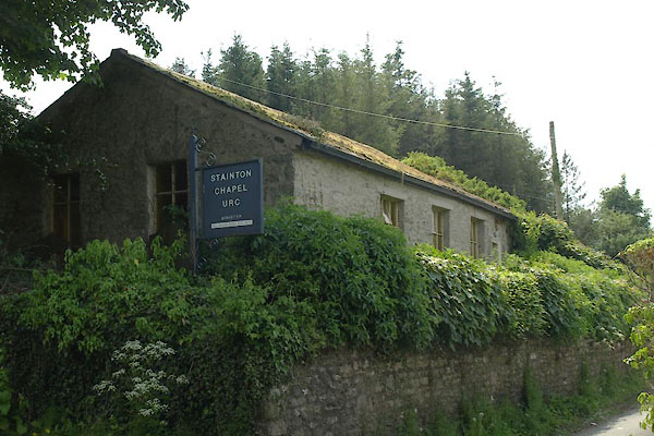


BYM99.jpg (taken 7.6.2013)
"Independent Chapel"
placename:- United Reformed Church
courtesy of English Heritage
"UNITED REFORMED CHURCH / / / STAINTON / SOUTH LAKELAND / CUMBRIA / II / 76537 / SD5259585973"
courtesy of English Heritage
"Independent Chapel now United Reformed Church. C17 with C19 refurbishment and extension to right. Roughcast render over rubble; graduated greenslate roof with slate ridge. Single storey, extension to right 2 storeys; built into slope. 6-panelled C19 door with moulded architrave, 3 windows to left, one to right all C19 casements; leaded lights in right-hand window. Door to lower floor to right. Interior has 4-bay roof with Queen strut trusses, ridge piece, morticed joint at apex and 2 levels of trenched purlins; fragment of pew from original Church bearing date 1695 ID ED; other furnishings C19."

 Lakes Guides menu.