 Old Cumbria Gazetteer
 |
 |
|
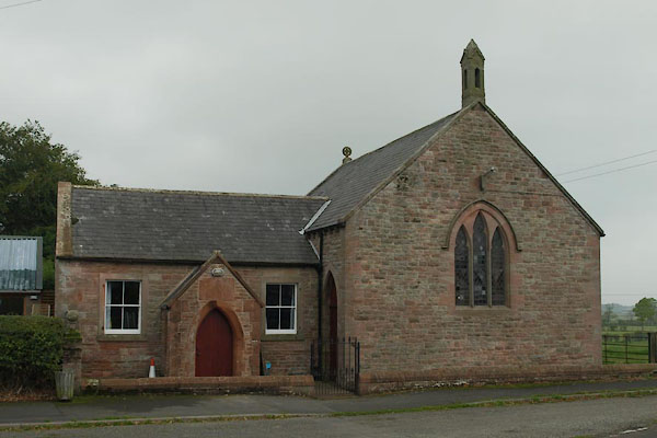
| village hall, Hutton End | ||
| locality:- | Hutton End | |
| civil parish:- | Skelton (formerly Cumberland) | |
| county:- | Cumbria | |
| locality type:- | village hall | |
| locality type:- | chapel (ex) | |
| locality type:- | methodist chapel | |
| coordinates:- | NY44963851 | |
| 1Km square:- | NY4438 | |
| 10Km square:- | NY43 | |
|
|
||
 BTQ12.jpg (taken 8.10.2010) |
||
|
|
||
| evidence:- | old map:- OS County Series (Cmd 39 14) |
|
| source data:- | Maps, County Series maps of Great Britain, scales 6 and 25
inches to 1 mile, published by the Ordnance Survey, Southampton,
Hampshire, from about 1863 to 1948. "Methodist Chapel (Wesleyan)" |
|
|
|
||
 Lakes Guides menu.