 Old Cumbria Gazetteer
 |
 |
|
| Braithwaite Bridge, Low Braithwaite | ||
| Braithwaite Bridge | ||
| site name:- | Braithwaite Beck | |
| locality:- | Low Braithwaite | |
| civil parish:- | Skelton (formerly Cumberland) | |
| civil parish:- | Hesket (formerly Cumberland) | |
| county:- | Cumbria | |
| locality type:- | bridge | |
| coordinates:- | NY42824219 | |
| 1Km square:- | NY4242 | |
| 10Km square:- | NY44 | |
|
|
||
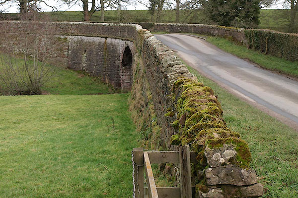 BUC10.jpg (taken 25.2.2011) 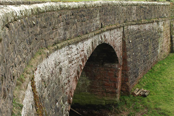 BUC11.jpg (taken 25.2.2011) |
||
|
|
||
| evidence:- | old map:- OS County Series (Cmd 39 5) |
|
| source data:- | Maps, County Series maps of Great Britain, scales 6 and 25
inches to 1 mile, published by the Ordnance Survey, Southampton,
Hampshire, from about 1863 to 1948. "Ford" |
|
|
|
||
| evidence:- | old map:- Donald 1774 (Cmd) |
|
| source data:- | Map, hand coloured engraving, 3x2 sheets, The County of Cumberland, scale about 1
inch to 1 mile, by Thomas Donald, engraved and published by Joseph Hodskinson, 29
Arundel Street, Strand, London, 1774.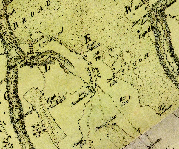 D4NY44SW.jpg double line across a river; a bridge at Low Braithwaite item:- Carlisle Library : Map 2 Image © Carlisle Library |
|
|
|
||
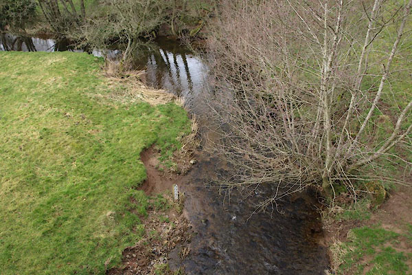 BUC13.jpg View of river. (taken 25.2.2011) 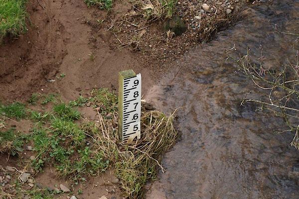 BUC14.jpg View of river. Depth gauge; and note the sandstone soil. (taken 25.2.2011) |
||
|
|
||
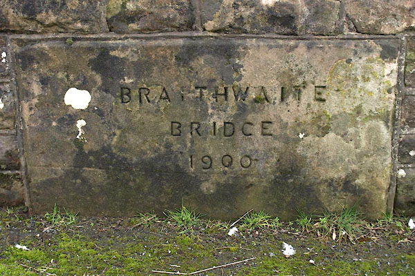 BUC12.jpg Plaque:- "BRAITHWAITE / BRIDGE / 1900" (taken 25.2.2011) |
||
|
|
||
 Lakes Guides menu.