 Old Cumbria Gazetteer
 |
 |
|
| Bowberhead Farm, Ravenstonedale | ||
| Bowberhead Farm | ||
| Street:- | Low Lane | |
| locality:- | Bowber Head | |
| civil parish:- | Ravenstonedale (formerly Westmorland) | |
| county:- | Cumbria | |
| locality type:- | buildings | |
| coordinates:- | NY74090320 | |
| 1Km square:- | NY7403 | |
| 10Km square:- | NY70 | |
| references:- | Listed Buildings 2010 |
|
|
|
||
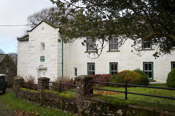 CCD58.jpg (taken 28.11.2014) 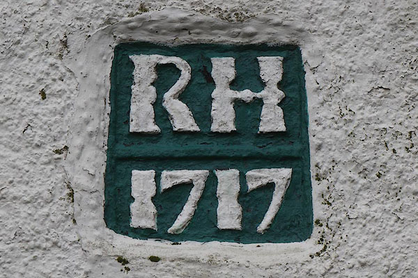 CCD59.jpg Date stone:- "RH / 1717" (taken 28.11.2014) |
||
|
|
||
| evidence:- | old map:- OS County Series (Wmd 30 9) placename:- Bowber Head |
|
| source data:- | Maps, County Series maps of Great Britain, scales 6 and 25
inches to 1 mile, published by the Ordnance Survey, Southampton,
Hampshire, from about 1863 to 1948. |
|
|
|
||
| evidence:- | old map:- Jefferys 1770 (Wmd) placename:- Bowber Head |
|
| source data:- | Map, 4 sheets, The County of Westmoreland, scale 1 inch to 1
mile, surveyed 1768, and engraved and published by Thomas
Jefferys, London, 1770.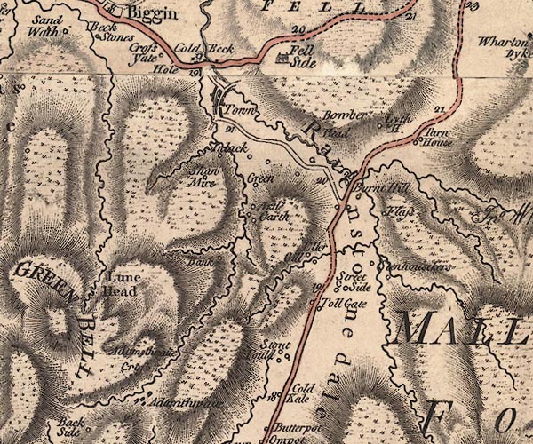 J5NY70SW.jpg "Bowber Head" no symbol item:- National Library of Scotland : EME.s.47 Image © National Library of Scotland |
|
|
|
||
| evidence:- | database:- Listed Buildings 2010 placename:- Bowberhead Farm |
|
| source data:- | courtesy of English Heritage "BOWBERHEAD FARMHOUSE AND BYRES ADJOINING / / LOW LANE / RAVENSTONEDALE / EDEN / CUMBRIA / II / 74137 / NY7409703219" |
|
|
|
||
| evidence:- | database:- Listed Buildings 2010 |
|
| source data:- | courtesy of English Heritage "BANK BARN 15 YARDS NORTH OF BOWBERHEAD FARMHOUSE / / LOW LANE / RAVENSTONEDALE / EDEN / CUMBRIA / II / 74138 / NY7408003181" |
|
|
|
||
 Lakes Guides menu.