 Old Cumbria Gazetteer
 |
 |
|
| boundary stone, Nether Wasdale (2) | ||
| civil parish:- | Nether Wasdale (formerly Cumberland) | |
| county:- | Cumbria | |
| locality type:- | boundary stone | |
| coordinates:- | NY16780680 | |
| 1Km square:- | NY1606 | |
| 10Km square:- | NY10 | |
| references:- | Listed Buildings 2010 |
|
|
|
||
 BYO43.jpg (taken 18.6.2013) 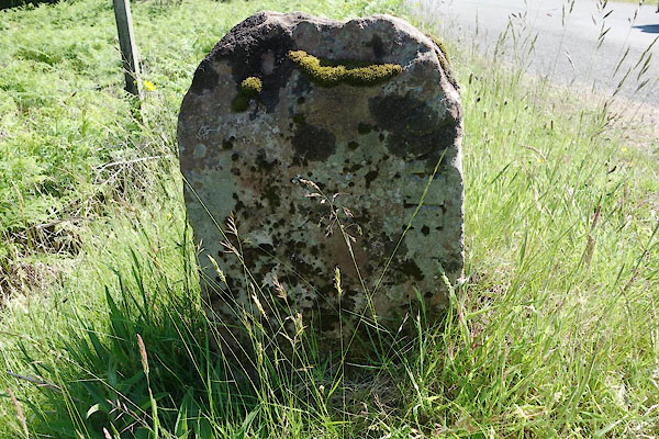 BYO44.jpg (taken 18.6.2013) |
||
|
|
||
| evidence:- | database:- Listed Buildings 2010 |
|
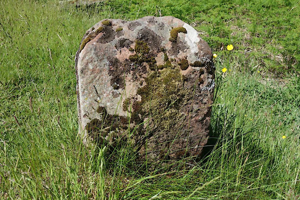
| source data:- | courtesy of English Heritage "BOUNDARY STONE CIRCA 15 FEET EAST OF OVERBECK BRIDGE ON NORTH SIDE OF ROAD / / / WASDALE / COPELAND / CUMBRIA / II / 76278 / NY1678806804" |
|
| source data:- | courtesy of English Heritage "Boundary stone; probably mid/late C19. Monolithic sandstone block, c2 ft high, with semicircular-head. Weathered inscription, in Roman lettering, on west face: .....RDALE (probably BOWDERDALE)." |
|
|
|
||
 Lakes Guides menu.