 Old Cumbria Gazetteer
 |
 |
|
| boundary stone, Culgaith | ||
| civil parish:- | Culgaith (formerly Cumberland) | |
| civil parish:- | Hunsonby (formerly Cumberland) | |
| county:- | Cumbria | |
| locality type:- | boundary stone | |
| coordinates:- | NY59633444 | |
| 1Km square:- | NY5934 | |
| 10Km square:- | NY53 | |
| references:- | Listed Buildings 2010 |
|
|
|
||
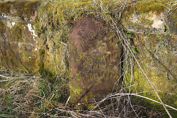 CCM19.jpg (taken 20.2.2015) |
||
|
|
||
| evidence:- | database:- Listed Buildings 2010 |
|
| source data:- | courtesy of English Heritage "BOUNDARY STONE SET AGAINST CENTRE OF BRIDGE PARAPET EAST OF ELLERCOW FARM / / / CULGAITH / EDEN / CUMBRIA / II / 73152 / NY5963134429" |
|
| source data:- | courtesy of English Heritage "Boundary stone; C19. Angled sides and top. Roman lettering on both faces, badly weathered: TOWNSHIP OF HUNSONBY on north and TOWNSHIP OF SKIRWITH on south." |
|
|
|
||
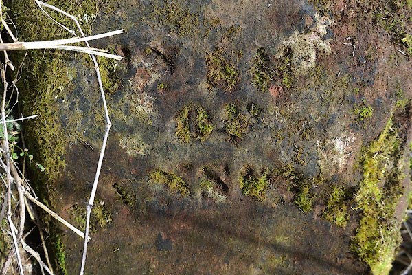 CCM20.jpg "[TOWNSHIP / OF / HUNSONBY]" (taken 20.2.2015) 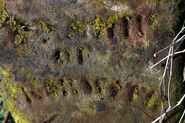 CCM21.jpg "[TOWNSHIP / OF / SKIRWITH]" (taken 20.2.2015) |
||
|
|
||
 Lakes Guides menu.