 Old Cumbria Gazetteer
 |
 |
|
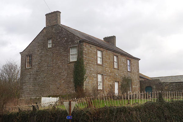
| Banks Foot, Banks | ||
| Banks Foot | ||
| locality:- | Banks | |
| locality:- | Hadrian's Wall | |
| civil parish:- | Burtholme (formerly Cumberland) | |
| county:- | Cumbria | |
| locality type:- | buildings | |
| coordinates:- | NY56516438 | |
| 1Km square:- | NY5664 | |
| 10Km square:- | NY56 | |
| references:- | Listed Buildings 2010 |
|
|
|
||
 CEM86.jpg (taken 25.1.2016) |
||
|
|
||
| evidence:- | old map:- OS County Series (Cmd 12 14) placename:- Banksfoot |
|
| source data:- | Maps, County Series maps of Great Britain, scales 6 and 25
inches to 1 mile, published by the Ordnance Survey, Southampton,
Hampshire, from about 1863 to 1948. |
|
|
|
||
| evidence:- | database:- Listed Buildings 2010 placename:- Banks Foot |
|
| source data:- | courtesy of English Heritage "BANKS FOOT AND ADJOINING OUTBUILDINGS / / / BURTHOLME / CARLISLE / CUMBRIA / II / 78135 / NY5651564380" |
|
|
|
||
 Lakes Guides menu.