 Old Cumbria Gazetteer
 |
 |
|
| Church View, Old Hutton | ||
| Church View | ||
| locality:- | Old Hutton | |
| civil parish:- | Old Hutton and Holmescales (formerly Westmorland) | |
| county:- | Cumbria | |
| locality type:- | buildings | |
| coordinates:- | SD55948865 | |
| 1Km square:- | SD5588 | |
| 10Km square:- | SD58 | |
|
|
||
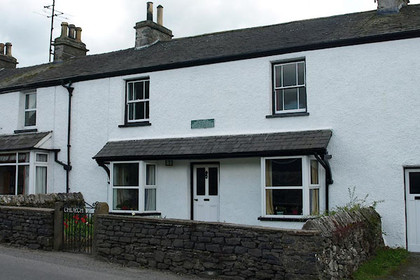 BSR96.jpg (taken 7.5.2010)  BSR97.jpg "REVD. JOHN WESLEY M.A. / LODGED HERE ON THE NIGHT OF / OCTOBER 3rd 1749 WHEN JOURNEYING ON / HORSEBACK FROM WHITEHAVEN TO LEEDS. / THIS WAS HIS FIRST VISIT TO WESTMORLAND." (taken 7.5.2010) Plaque:- |
||
|
|
||
| evidence:- | old map:- OS County Series (Wmd 39 14) placename:- Chapel Houses |
|
| source data:- | Maps, County Series maps of Great Britain, scales 6 and 25
inches to 1 mile, published by the Ordnance Survey, Southampton,
Hampshire, from about 1863 to 1948. "Chapel Houses" |
|
|
|
||
| evidence:- | old map:- Jefferys 1770 (Wmd) placename:- Chapel House |
|
| source data:- | Map, 4 sheets, The County of Westmoreland, scale 1 inch to 1
mile, surveyed 1768, and engraved and published by Thomas
Jefferys, London, 1770.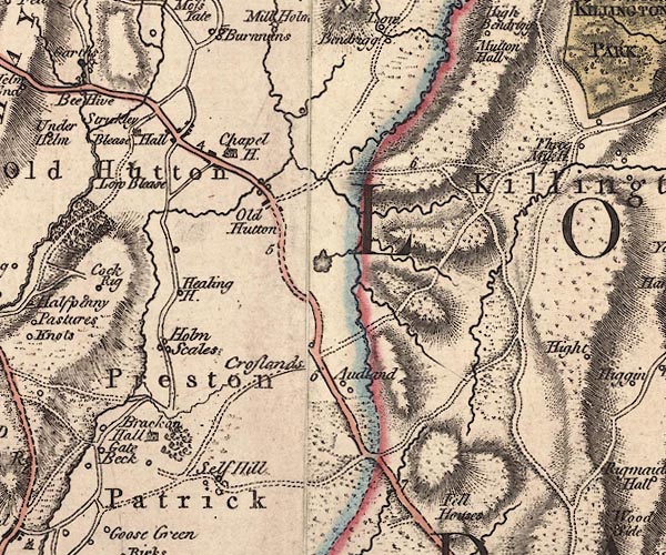 J5SD58NE.jpg "Chapel H." blocks item:- National Library of Scotland : EME.s.47 Image © National Library of Scotland |
|
|
|
||
| evidence:- | old map:- Cary 1789 (edn 1805) placename:- Chapel House |
|
| source data:- | Map, uncoloured engraving, Westmoreland, scale about 2.5 miles
to 1 inch, by John Cary, London, 1789; edition 1805.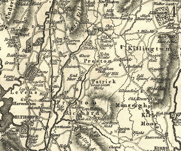 CY24SD58.jpg "Cha. Ho." house symbol; large house item:- JandMN : 129 Image © see bottom of page |
|
|
|
||
| evidence:- | old map:- Laurie and Whittle 1806 placename:- Chapel House |
|
| source data:- | Road map, Completion of the Roads to the Lakes, scale about 10
miles to 1 inch, by Nathaniel Coltman? 1806, published by Robert
H Laurie, 53 Fleet Street, London, 1834. click to enlarge click to enlargeLw18.jpg "Chapel House" village or other place item:- private collection : 18.18 Image © see bottom of page |
|
|
|
||
| evidence:- | old map:- Laurie and Whittle 1806 placename:- Chapel House |
|
| source data:- | Road map, Completion of the Roads to the Lakes, scale about 10
miles to 1 inch, by Nathaniel Coltman? 1806, published by Robert
H Laurie, 53 Fleet Street, London, 1834. click to enlarge click to enlargeLw21.jpg "Chapel House 260½" village or other place; distance from London; travellers supplied with post horses or carriages item:- private collection : 18.18 Image © see bottom of page |
|
|
|
||
 Lakes Guides menu.