 Old Cumbria Gazetteer
 |
 |
|
| Redgategill Viaduct, Winton | ||
| Redgategill Viaduct | ||
| site name:- | South Durham and Lancashire Union Railway | |
| site name:- | Redgate Gill | |
| civil parish:- | Winton (formerly Westmorland) | |
| county:- | Cumbria | |
| locality type:- | railway viaduct | |
| locality type:- | viaduct | |
| coordinates:- | NY81601034 | |
| coordinates:- | NY81511037 | |
| 1Km square:- | NY8110 | |
| 10Km square:- | NY81 | |
| references:- | OS County Series |
|
|
|
||
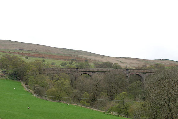 BSP77.jpg (taken 30.4.2010) |
||
|
|
||
| evidence:- | old map:- OS County Series (Wmd 23) placename:- Redgategill Viaduct |
|
| source data:- | Maps, County Series maps of Great Britain, scales 6 and 25
inches to 1 mile, published by the Ordnance Survey, Southampton,
Hampshire, from about 1863 to 1948. "Redgategill Viaduct" |
|
|
|
||
 Lakes Guides menu.