 Old Cumbria Gazetteer
 |
 |
|
| Finsthwaite and Lakeside Village Hall, Finsthwaite | ||
| Finsthwaite and Lakeside Village Hall | ||
| Finsthwaite School | ||
| locality:- | Finsthwaite | |
| civil parish:- | Colton (formerly Lancashire) | |
| county:- | Cumbria | |
| locality type:- | village hall | |
| locality type:- | school (ex) | |
| coordinates:- | SD36868778 | |
| 1Km square:- | SD3687 | |
| 10Km square:- | SD38 | |
|
|
||
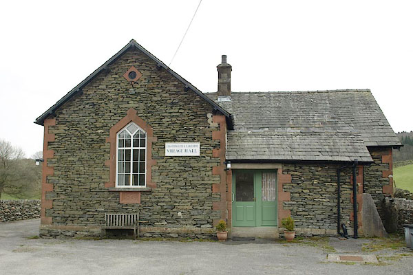 BSM10.jpg (taken 9.4.2010) 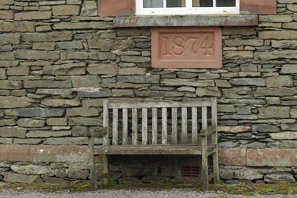 BSM11.jpg Plaque:- "1874" (taken 9.4.2010) |
||
|
|
||
| evidence:- | old map:- OS County Series (Lan 8 10) |
|
| source data:- | Maps, County Series maps of Great Britain, scales 6 and 25
inches to 1 mile, published by the Ordnance Survey, Southampton,
Hampshire, from about 1863 to 1948. "School" |
|
|
|
||
 Lakes Guides menu.