 Old Cumbria Gazetteer
 |
 |
|
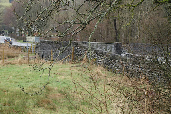
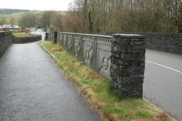
| Pool Bridge, Hawkshead | ||
| Pool Bridge | ||
| site name:- | Black Beck (4) | |
| civil parish:- | Hawkshead (formerly Lancashire) | |
| civil parish:- | Claife (formerly Lancashire) | |
| county:- | Cumbria | |
| locality type:- | bridge | |
| locality type:- | boundary feature | |
| locality type:- | parish boundary feature | |
| coordinates:- | SD35509806 | |
| 1Km square:- | SD3598 | |
| 10Km square:- | SD39 | |
|
|
||
 BSJ96.jpg (taken 30.3.2010) 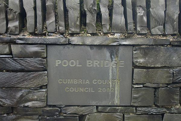 BSJ99.jpg Newer plaque:- "POOL BRIDGE / CUMBRIA COUNTY / COUNCIL 2002" (taken 30.3.2010) |
||
|
|
||
| evidence:- | old map:- OS County Series (Lan 5 2) placename:- Pool Bridge |
|
| source data:- | Maps, County Series maps of Great Britain, scales 6 and 25
inches to 1 mile, published by the Ordnance Survey, Southampton,
Hampshire, from about 1863 to 1948. |
|
|
|
||
| evidence:- | old map:- OS County Series (Lan 5) placename:- Pool Bridge |
|
| source data:- | Maps, County Series maps of Great Britain, scales 6 and 25
inches to 1 mile, published by the Ordnance Survey, Southampton,
Hampshire, from about 1863 to 1948. "Pool Bridge" |
|
|
|
||
| evidence:- | old map:- Jefferys 1770 (Wmd) |
|
| source data:- | Map, 4 sheets, The County of Westmoreland, scale 1 inch to 1
mile, surveyed 1768, and engraved and published by Thomas
Jefferys, London, 1770.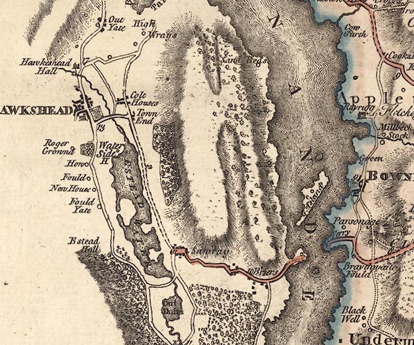 J5SD39NE.jpg double line, road, across a stream; bridge item:- National Library of Scotland : EME.s.47 Image © National Library of Scotland |
|
|
|
||
 BSJ97.jpg (taken 30.3.2010) 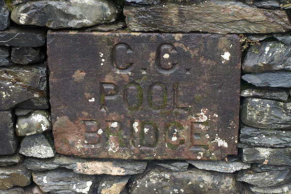 BSJ98.jpg Older plaque:- "C. C. / POOL / BRIDGE" (taken 30.3.2010) |
||
|
|
||
 Lakes Guides menu.