 Old Cumbria Gazetteer
 |
 |
|
| milestone, Durham (5) | ||
| site name:- | road, Bowes to Brough | |
| locality:- | ||
| county:- | Durham | |
| locality type:- | milestone | |
| coordinates:- | NY90221230 | |
| 1Km square:- | NY9012 | |
| 10Km square:- | NY91 | |
|
|
||
| evidence:- | old map:- OS County Series (Yrk 11) |
|
| source data:- | Maps, County Series maps of Great Britain, scales 6 and 25
inches to 1 mile, published by the Ordnance Survey, Southampton,
Hampshire, from about 1863 to 1948. "M.S. BROUGH 6" |
|
|
|
||
| evidence:- | possibly old map:- Jefferys 1770 (Wmd) |
|
| source data:- | Map, 4 sheets, The County of Westmoreland, scale 1 inch to 1
mile, surveyed 1768, and engraved and published by Thomas
Jefferys, London, 1770.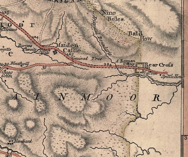 J5NY81SE.jpg "21" milestone marked by road item:- National Library of Scotland : EME.s.47 Image © National Library of Scotland |
|
|
|
||
 Lakes Guides menu.