 Old Cumbria Gazetteer
 |
 |
|
| milestone, Lorton (3) | ||
| site name:- | road, Keswick to Cockermouth | |
| locality:- | Whinlatter Pass | |
| civil parish:- | Lorton (formerly Cumberland) | |
| county:- | Cumbria | |
| locality type:- | milestone | |
| coordinates:- | NY18602481 | |
| 1Km square:- | NY1824 | |
| 10Km square:- | NY12 | |
| altitude:- | 834.4 feet (less a bit) | |
| altitude:- | 254m (less a bit) | |
| references:- | OS County Series |
|
|
|
||
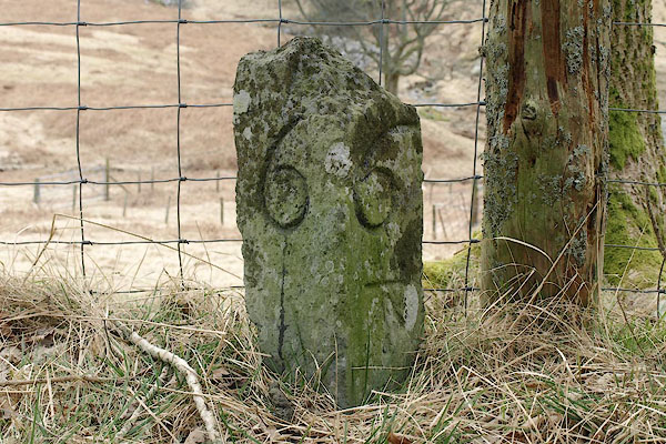 BSH97.jpg Inscribed stone "6 / 6" and a bench mark (taken 19.3.2010) |
||
|
|
||
| evidence:- | old map:- OS County Series (Cmd 63 3) |
|
| source data:- | Maps, County Series maps of Great Britain, scales 6 and 25
inches to 1 mile, published by the Ordnance Survey, Southampton,
Hampshire, from about 1863 to 1948. "M.S. Cockermouth .. 6 Keswick .. 6" "B.M. 834.4" |
|
|
|
||
 Lakes Guides menu.