 Old Cumbria Gazetteer
 |
 |
|
| Newbiggin Station, Ravenstonedale | ||
| Newbiggin Station | ||
| Newbiggin-on-Lune Station | ||
| Ravenstonedale Station | ||
| Brantwood | ||
| site name:- | South Durham and Lancashire Union Railway | |
| locality:- | Newbiggin-on-Lune | |
| civil parish:- | Ravenstonedale (formerly Westmorland) | |
| county:- | Cumbria | |
| locality type:- | railway station (ex) | |
| locality type:- | buildings | |
| coordinates:- | NY70040535 | |
| 1Km square:- | NY7005 | |
| 10Km square:- | NY70 | |
| SummaryText:- | Opened as Newbiggin Station, with the railway, 1861; renamed Ravenstonedale Station 1877; closed 1952. | |
| references:- | OS County Series |
|
|
|
||
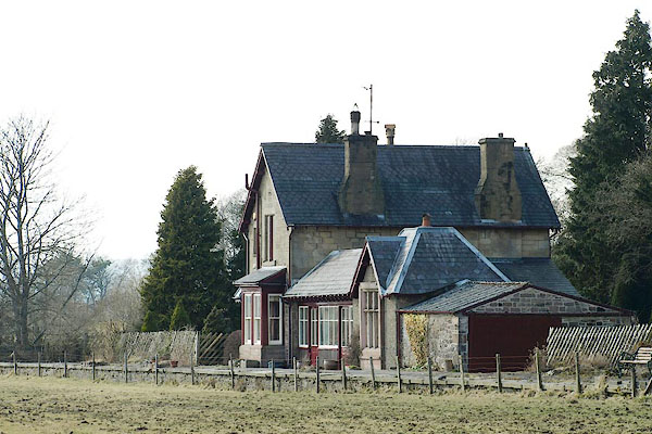
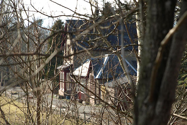 BSH62.jpg (taken 16.3.2010) 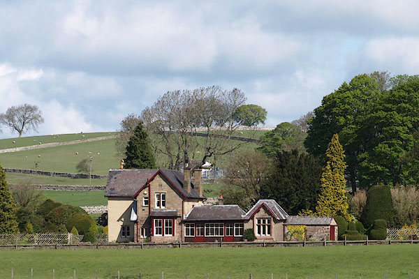 BSS59.jpg (taken 11.5.2010) |
||
|
|
||
| evidence:- | old map:- OS County Series (Wmd 29 8) placename:- Newbiggin Station item:- railway signal; railway milepost; railway bridge |
|
| source data:- | Maps, County Series maps of Great Britain, scales 6 and 25
inches to 1 mile, published by the Ordnance Survey, Southampton,
Hampshire, from about 1863 to 1948.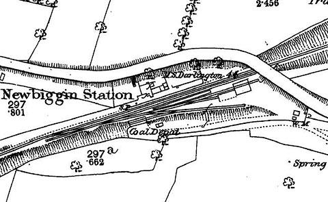 click to enlarge click to enlargeCSRY0202.jpg "Newbiggin Station / Coal Depot / S.P. / M.S. Darlington 44" |
|
|
|
||
 BSH63.jpg (taken 16.3.2010) 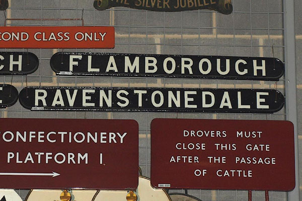 BPQ98.jpg Station sign. (taken 2008) courtesy of the National Railway Museum. |
||
|
|
||
 Lakes Guides menu.