 Old Cumbria Gazetteer
 |
 |
|
| Galloway Stone, Crosby Ravensworth | ||
| Galloway Stone | ||
| civil parish:- | Crosby Ravensworth (formerly Westmorland) | |
| county:- | Cumbria | |
| locality type:- | stone | |
| locality type:- | glacial erratic | |
| coordinates:- | NY58790994 | |
| 1Km square:- | NY5809 | |
| 10Km square:- | NY50 | |
|
|
||
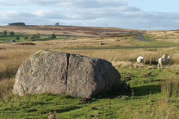 BRT16.jpg (taken 16.10.2009) 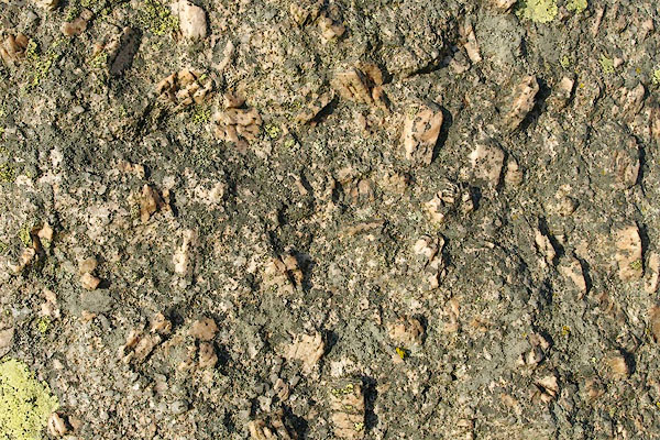 BRT18.jpg The rock is Shap Granite, a porphyry? (taken 16.10.2009) |
||
|
|
||
| evidence:- | old map:- OS County Series (Wmd 21 11) placename:- Galloway Stone |
|
| source data:- | Maps, County Series maps of Great Britain, scales 6 and 25
inches to 1 mile, published by the Ordnance Survey, Southampton,
Hampshire, from about 1863 to 1948. |
|
|
|
||
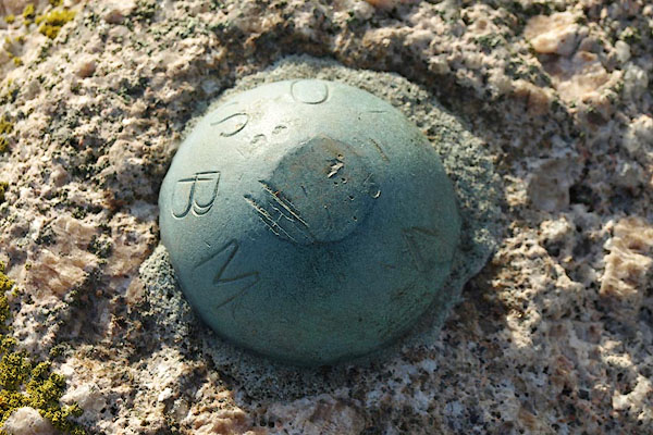 BRT17.jpg Bench mark on top of the stone, an unusually large rivet. (taken 16.10.2009) |
||
|
|
||
 Lakes Guides menu.