 Old Cumbria Gazetteer
 |
 |
|
| milestone, King's Meaburn (4) | ||
| site name:- | road, Appleby to King's Meaburn | |
| locality:- | King's Meaburn | |
| civil parish:- | King's Meaburn (formerly Westmorland) | |
| county:- | Cumbria | |
| locality type:- | milestone | |
| coordinates:- | NY62092111 | |
| 1Km square:- | NY6221 | |
| 10Km square:- | NY62 | |
|
|
||
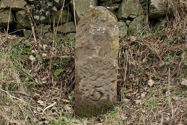 BSG96.jpg Inscribed stone:- "[ ] 5 [MILES]" (taken 12.3.2001) |
||
|
|
||
| evidence:- | old map:- OS County Series (Wmd 8 16) |
|
| source data:- | Maps, County Series maps of Great Britain, scales 6 and 25
inches to 1 mile, published by the Ordnance Survey, Southampton,
Hampshire, from about 1863 to 1948. "M.S. Appleby 5" |
|
|
|
||
 Lakes Guides menu.